64:
36:
71:
43:
279:
At Eianji Nishi Tomb, construction was carried out to cover the entire mound and stone chamber with a large dome-shaped roof for protection. At Eianji
Higashi Tomb, the stone chamber has been partially restored and a protective structure made of reinforced concrete has been installed, and visitors
237:
The Eianji kofun are located at the foot of a hill overlooking the alluvial plain on the right bank of the
Kikuchi River in northern Kumamoto Prefecture. The site takes is name from the ruins of a Buddhist temple called Eian-ji, which is located about 40 meters away. They are thought to have been
267:
with a stone roof. The walls have triangular engraved lines, suggesting that it was painted. The antechamber is currently 1.6 meters long, 2.3 meters wide and 1.6 meters high, and shallow vertical lines have been carved into two stones on either side of the back wall, with continuous triangular
271:
The Eianji Nishi Kofun is also thought to be a small circular tumulus, and the stone chamber is 3.4 meters long, 2.8 meters wide and 3 meters high, constructed on three sides from a single megalithic stone, with the stone roof of the back wall and parts of the
262:
with an opening to the southeast. Only a portion of the antechamber and burial chamber proper remain. The main burial chamber is 2.6 meters long, 2.4 meters wide, and 2.7 meters high and was made of huge monoliths of processed lava from
268:
patterns carved into the left and right sides and painted red. Circular patterns and patterns that appear to be boats and horses are also painted on the left and right side walls.
276:
remaining. It is also orientated to the south. Three rows of circular patterns are carved into the back wall and both side walls, and red paint remains in some places.
120:
63:
297:
395:
405:
35:
358:
400:
415:
410:
8:
281:
380:
226:
190:
354:
285:
222:
94:
322:
302:
242:
238:
built between the end of the 6th century and the first half of the 7th century.
259:
389:
135:
122:
245:. Although most of the mound has been lost, it is believed to have been an
215:
168:
280:
can now tour the site. The site is about 1.4 kilometers northeast of
264:
273:
70:
42:
108:
218:
98:
258:-style circular tumulus with a horizontal-entry stone
221:, located in the Tamana neighborhood of the city of
78:Eianji Higashi Kofun - Eianji Nishi Kofun (Japan)
387:
251:
207:
351:(国指定史跡事典) National Historic Site Encyclopedia
348:
325:(in Japanese). Agency for Cultural Affairs
298:List of Historic Sites of Japan (Kumamoto)
344:
342:
340:
203:Eianji Higashi Kofun・Eianji Nishi Kofun
50:Eianji Higashi Kofun・Eianji Nishi Kofun
17:Eianji Higashi Kofun・Eianji Nishi Kofun
388:
349:Isomura, Yukio; Sakai, Hideya (2012).
337:
315:
13:
14:
427:
374:
69:
62:
41:
34:
227:National Historic Site of Japan
225:. The tumuli were designated a
191:National Historic Site of Japan
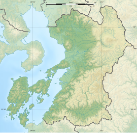
53:Show map of Kumamoto Prefecture
396:History of Kumamoto Prefecture
241:The Eianji Higashi Kofun is a
1:
308:
7:
291:
232:
10:
432:
252:
208:
187:
179:
174:
164:
159:
151:
114:
104:
90:
28:
21:
406:Historic Sites of Japan
136:32.95167°N 130.57667°E
381:Tamana City home page
282:Shin-Tamana Station
183:Yes (no facilities)
141:32.95167; 130.57667
132: /
18:
180:Public access
16:
286:Kyushu Shinkansen
198:
197:
81:Show map of Japan
423:
401:Tamana, Kumamoto
368:
367:
364:
346:
335:
334:
332:
330:
319:
257:
255:
254:
223:Tamana, Kumamoto
213:
211:
210:
147:
146:
144:
143:
142:
137:
133:
130:
129:
128:
125:
95:Tamana, Kumamoto
82:
73:
72:
66:
54:
45:
44:
38:
19:
15:
431:
430:
426:
425:
424:
422:
421:
420:
416:Decorated kofun
386:
385:
377:
372:
371:
365:
361:
347:
338:
328:
326:
323:"永安寺東古墳・永安寺西古墳"
321:
320:
316:
311:
303:Decorated kofun
294:
249:
243:decorated kofun
235:
205:
200:
194:
193:
140:
138:
134:
131:
126:
123:
121:
119:
118:
86:
85:
84:
83:
80:
79:
76:
75:
74:
57:
56:
55:
52:
51:
48:
47:
46:
24:
12:
11:
5:
429:
419:
418:
413:
408:
403:
398:
384:
383:
376:
375:External links
373:
370:
369:
359:
336:
313:
312:
310:
307:
306:
305:
300:
293:
290:
260:burial chamber
234:
231:
196:
195:
189:
188:
185:
184:
181:
177:
176:
172:
171:
166:
162:
161:
157:
156:
153:
149:
148:
116:
112:
111:
106:
102:
101:
92:
88:
87:
77:
68:
67:
61:
60:
59:
58:
49:
40:
39:
33:
32:
31:
30:
29:
26:
25:
22:
9:
6:
4:
3:
2:
428:
417:
414:
412:
409:
407:
404:
402:
399:
397:
394:
393:
391:
382:
379:
378:
366:(in Japanese)
362:
356:
352:
345:
343:
341:
324:
318:
314:
304:
301:
299:
296:
295:
289:
287:
283:
277:
275:
274:paving stones
269:
266:
261:
248:
244:
239:
230:
228:
224:
220:
219:burial mounds
217:
209:永安寺東古墳・永安寺西古墳
204:
192:
186:
182:
178:
173:
170:
167:
163:
158:
154:
150:
145:
117:
113:
110:
107:
103:
100:
96:
93:
89:
65:
37:
27:
23:永安寺東古墳・永安寺西古墳
20:
350:
327:. Retrieved
317:
278:
270:
246:
240:
236:
216:Kofun period
202:
199:
169:Kofun period
411:Round Kofun
214:are a pair
139: /
127:130°34′36″E
115:Coordinates
390:Categories
360:4311750404
329:August 20,
309:References
229:in 1992.
175:Site notes
124:32°57′06″N
265:Mount Aso
292:See also
233:Overview
91:Location
353:. 学生社.
284:on the
165:Periods
160:History
357:
109:Kyushu
105:Region
247:enpun
155:Kofun
99:Japan
355:ISBN
331:2021
201:The
152:Type
392::
339:^
288:.
253:円墳
97:,
363:.
333:.
256:)
250:(
212:)
206:(
Text is available under the Creative Commons Attribution-ShareAlike License. Additional terms may apply.

