38:
672:"}},"text\/plain":{"en":{"":"inception"}}},"{\"value\":{\"time\":\"+2010-11-16T00:00:00Z\",\"timezone\":0,\"before\":0,\"after\":0,\"precision\":11,\"calendarmodel\":\"http:\\\/\\\/www.wikidata.org\\\/entity\\\/Q1985727\"},\"type\":\"time\"}":{"text\/html":{"en":{"P571":"16 November 2010"}},"text\/plain":{"en":{"P571":"16 November 2010"}}}}": -->
452:
364:
309:
224:
229:
94:
611:"}},"text\/plain":{"en":{"P275":"Creative Commons Attribution-ShareAlike 3.0 Unported"}}},"{\"value\":{\"entity-type\":\"item\",\"numeric-id\":50829104,\"id\":\"Q50829104\"},\"type\":\"wikibase-entityid\"}":{"text\/html":{"en":{"P275":"
472:"}},"text\/plain":{"en":{"P2699":"https:\/\/commons.wikimedia.org\/wiki\/user:Nilfanion"}}},"{\"value\":{\"entity-type\":\"property\",\"numeric-id\":4174,\"id\":\"P4174\"},\"type\":\"wikibase-entityid\"}":{"text\/html":{"en":{"":"
464:"}},"text\/plain":{"en":{"P2093":"Nilfanion","P4174":"Nilfanion"}}},"{\"value\":{\"entity-type\":\"property\",\"numeric-id\":2699,\"id\":\"P2699\"},\"type\":\"wikibase-entityid\"}":{"text\/html":{"en":{"":"
607:"}},"text\/plain":{"en":{"":"copyright license"}}},"{\"value\":{\"entity-type\":\"item\",\"numeric-id\":14946043,\"id\":\"Q14946043\"},\"type\":\"wikibase-entityid\"}":{"text\/html":{"en":{"P275":"
563:"}},"text\/plain":{"en":{"":"copyright status"}}},"{\"value\":{\"entity-type\":\"item\",\"numeric-id\":50423863,\"id\":\"Q50423863\"},\"type\":\"wikibase-entityid\"}":{"text\/html":{"en":{"P6216":"
456:"}},"text\/plain":{"en":{"":"creator"}}},"{\"value\":{\"entity-type\":\"property\",\"numeric-id\":2093,\"id\":\"P2093\"},\"type\":\"wikibase-entityid\"}":{"text\/html":{"en":{"":"
559:
460:"}},"text\/plain":{"en":{"":"author name string"}}},"{\"value\":\"Nilfanion\",\"type\":\"string\"}":{"text\/html":{"en":{"P2093":"Nilfanion","P4174":"
468:"}},"text\/plain":{"en":{"":"URL"}}},"{\"value\":\"https:\\\/\\\/commons.wikimedia.org\\\/wiki\\\/user:Nilfanion\",\"type\":\"string\"}":{"text\/html":{"en":{"P2699":"
270:– You must give appropriate credit, provide a link to the license, and indicate if changes were made. You may do so in any reasonable manner, but not in any way that suggests the licensor endorses you or your use.
1371:
401:
461:
376:
1293:
784:
612:
608:
564:
469:
1760:
560:
473:
465:
457:
669:
604:
453:
1616:
68:
64:
1076:
60:
56:
52:
48:
42:
1366:
326:
105:
1681:
77:
1376:
615:"}},"text\/plain":{"en":{"P275":"GNU Free Documentation License, version 1.2 or later"}}}}": -->
382:
324:; with no Invariant Sections, no Front-Cover Texts, and no Back-Cover Texts. A copy of the license is included in the section entitled
179:
655:
638:
590:
1166:
277:
574:
538:
523:
510:
316:
679:
622:
483:
442:
1611:
393:
1751:
1351:
545:
1066:
239:
1671:
901:
1601:
783:
More than 100 pages use this file. The following list shows the first 100 pages that use this file only. A
321:
1711:
1361:
1276:
881:
836:
747:
742:
37:
276:– If you remix, transform, or build upon the material, you must distribute your contributions under the
1286:
1221:
1211:
1171:
1116:
1106:
1056:
956:
916:
796:
791:
476:"}},"text\/plain":{"en":{"":"Wikimedia username"}}}}": -->
876:
806:
567:"}},"text\/plain":{"en":{"P6216":"copyrighted"}}}}": -->
1626:
1146:
1101:
1046:
1011:
951:
911:
896:
168:
1096:
946:
941:
866:
816:
113:
1191:
1181:
530:
370:
856:
1506:
1036:
314:
Permission is granted to copy, distribute and/or modify this document under the terms of the
996:
986:
971:
236:
8:
1411:
1256:
891:
861:
846:
801:
1231:
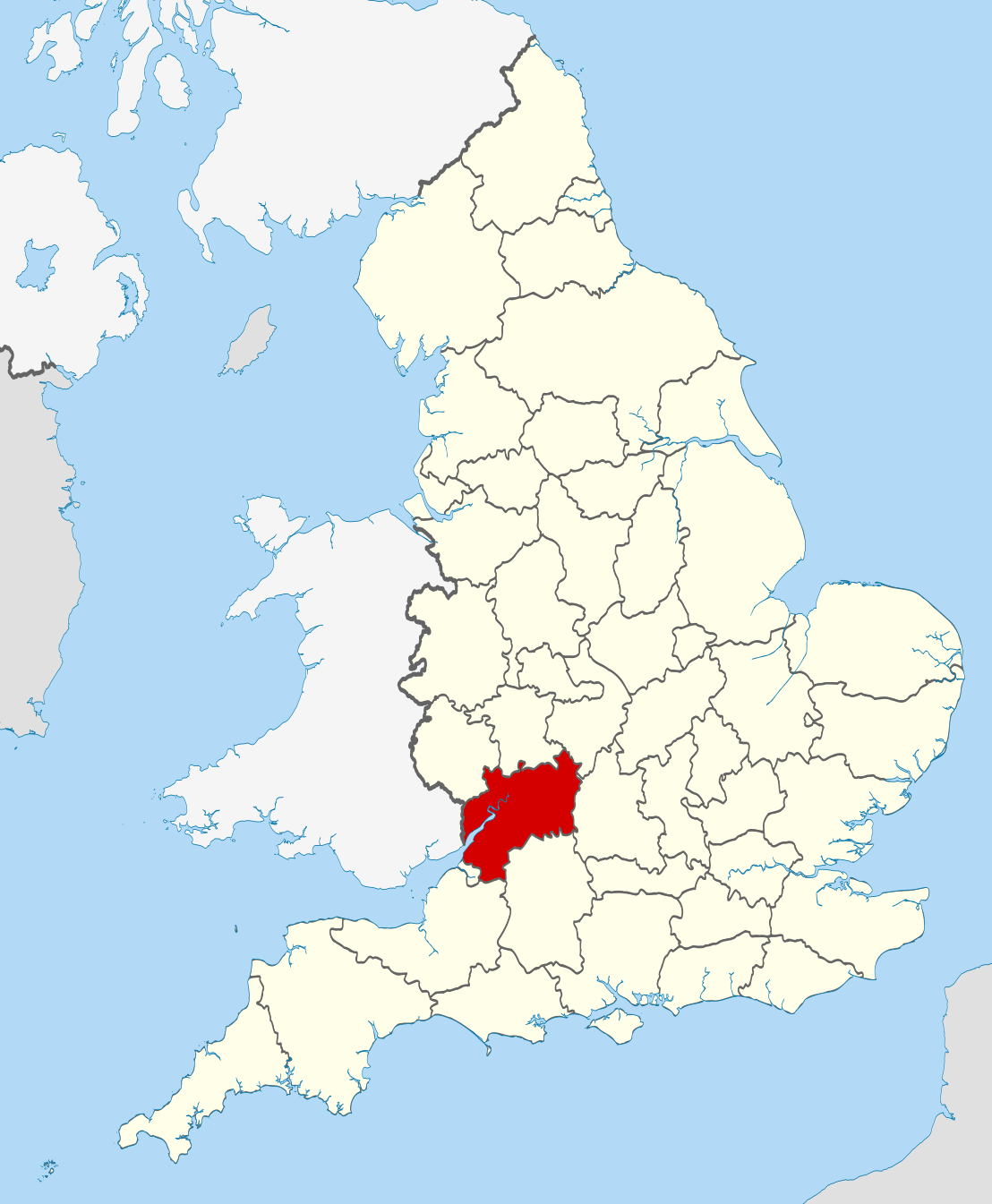
1261:
1251:
976:
1476:
926:
886:
211:
I, the copyright holder of this work, hereby publish it under the following licenses:
100:
1701:
432:
1386:
1266:
1226:
1206:
165:
143:
1321:
1606:
1241:
1196:
1061:
1001:
936:
770:
766:
195:
1521:
1246:
1236:
1131:
981:
826:
821:
811:
758:
765:== Summary == {{Information |Description=Location of the ceremonial county of
1201:
1176:
1136:
1016:
991:
921:
402:
Commons:Valued image candidates/Locator maps of
English ceremonial counties
689:
649:
632:
584:
493:
1281:
1186:
1151:
1121:
1071:
906:
1126:
1086:
1081:
961:
185:
Irish, French and Isle of Man coastlines, Lough Neagh and Irish border
1636:
1041:
1031:
966:
851:
358:
303:
1271:
1141:
1111:
1021:
871:
831:
715:
Click on a date/time to view the file as it appeared at that time.
1666:
1216:
1161:
1026:
1006:
931:
841:
381:
on
Wikimedia Commons. The image set has been assessed under the
1091:
1656:
1741:
1731:
1646:
1591:
1541:
1451:
1421:
1396:
1341:
1051:
82:(SVG file, nominally 1,108 × 1,345 pixels, file size: 302 KB)
1721:
1691:
1581:
1571:
1561:
1551:
1531:
1516:
1496:
1486:
1471:
1461:
1441:
1431:
1406:
1331:
1311:
1156:
154:
88:
1077:
426:
Add a one-line explanation of what this file represents
781:
470:
https:\/\/commons.wikimedia.org\/wiki\/user:Nilfanion
1302:
713:
656:
639:
Creative
Commons Attribution-ShareAlike 3.0 Unported
613:
609:
Creative
Commons Attribution-ShareAlike 3.0 Unported
320:, Version 1.2 or any later version published by the
112:
Commons is a freely licensed media file repository.
377:Locator maps of the Ceremonial counties of England
1672:Apvienotās Karalistes administratīvais iedalījums
1412:Llista de comtats cerimonials d'Anglaterra
369:This is one of the images forming part of the
287:https://creativecommons.org/licenses/by-sa/3.0
93:
293:Creative Commons Attribution-Share Alike 3.0
217:
150:
135:
531:https://commons.wikimedia.org/user:Nilfanion
191:
160:
14:
253:– to copy, distribute and transmit the work
41:Size of this PNG preview of this SVG file:
352:You may select the license of your choice.
1477:Anexo:Condados ceremoniales de Inglaterra
1304:The following other wikis use this file:
1167:St Mary's Priory Church, Deerhurst
180:National Geospatial-Intelligence Agency
138:Gloucestershire UK locator map 2010.svg
1702:Comtats ceremonials d'Anglatèrra
142:Location of the ceremonial county of
124:
1387:Lec'hanvioù kembraek e Bro-Saoz
332:http://www.gnu.org/copyleft/fdl.html
240:Attribution-Share Alike 3.0 Unported
706:
228:
223:
13:
1522:Englannin muodolliset kreivikunnat
431:
425:
390:
351:
214:
210:
175:County boundaries and GB coastline
125:
75:
1772:
1348:Usage on be-tarask.wikipedia.org
430:
416:
362:
308:
307:
264:Under the following conditions:
235:This file is licensed under the
227:
222:
216:
92:
31:
21:
413:
363:
1372:Категория:Градове в Глостършър
1299:
1067:Knightsbridge, Gloucestershire
710:
412:
399:You can see its nomination at
394:Ceremonial counties of England
387:the most valued set on Commons
338:GNU Free Documentation License
327:GNU Free Documentation License
317:GNU Free Documentation License
26:
1:
902:Brockhampton, Gloucestershire
778:
438:Items portrayed in this file
204:
7:
1748:Usage on pnb.wikipedia.org
1738:Usage on pl.wiktionary.org
1728:Usage on pl.wikivoyage.org
1643:Usage on lld.wikipedia.org
1588:Usage on it.wikivoyage.org
1538:Usage on fr.wiktionary.org
1448:Usage on en.wiktionary.org
1418:Usage on ceb.wikipedia.org
1393:Usage on br.wiktionary.org
1338:Usage on ast.wikipedia.org
1318:Usage on ang.wikipedia.org
1277:Withington, Gloucestershire
882:Boddington, Gloucestershire
837:Bamfurlong, Gloucestershire
10:
1777:
1718:Usage on pl.wikipedia.org
1708:Usage on os.wikipedia.org
1698:Usage on oc.wikipedia.org
1688:Usage on nl.wikipedia.org
1678:Usage on mr.wikipedia.org
1663:Usage on lv.wikipedia.org
1653:Usage on lt.wikipedia.org
1633:Usage on la.wikipedia.org
1623:Usage on ko.wikipedia.org
1598:Usage on ja.wikipedia.org
1578:Usage on ia.wikipedia.org
1568:Usage on hu.wikipedia.org
1558:Usage on gl.wikipedia.org
1548:Usage on ga.wikipedia.org
1528:Usage on fr.wikipedia.org
1513:Usage on fi.wikipedia.org
1503:Usage on fa.wikipedia.org
1493:Usage on eu.wikipedia.org
1483:Usage on et.wikipedia.org
1468:Usage on es.wikipedia.org
1458:Usage on eo.wikipedia.org
1438:Usage on da.wikipedia.org
1428:Usage on cs.wikipedia.org
1403:Usage on ca.wikipedia.org
1383:Usage on br.wikipedia.org
1358:Usage on bg.wikipedia.org
1328:Usage on an.wikipedia.org
1308:Usage on af.wikipedia.org
1287:Workmans Wood, Sheepscombe
1222:Uckington, Gloucestershire
1212:Tibberton, Gloucestershire
1172:Staverton, Gloucestershire
1117:River Cam, Gloucestershire
1107:Northleach with Eastington
1057:Kingswood, Stroud District
957:Dodington, Gloucestershire
917:Cambridge, Gloucestershire
797:Alkington, Gloucestershire
792:Ablington, Gloucestershire
278:same or compatible license
132:
127:
877:Blakeney, Gloucestershire
807:Amberley, Gloucestershire
707:
383:valued image set criteria
16:
1637:Glocestriensis comitatus
1147:Shipton, Gloucestershire
1102:Newport, Gloucestershire
1047:Horsley, Gloucestershire
1012:Gretton, Gloucestershire
952:Cranham, Gloucestershire
912:Brookthorpe-with-Whaddon
897:Boxwell with Leighterton
769:within England. |Source=
415:
374:
322:Free Software Foundation
244:
99:This is a file from the
36:
1097:Montpellier, Cheltenham
947:Coombe Hill, Tewkesbury
942:Coombe, Gloucestershire
867:Blackfriars, Gloucester
857:Bishop's Hill Wood
817:Ashley, Gloucestershire
764:
743:22:36, 23 November 2010
153:
103:. Information from its
1192:Swell, Gloucestershire
1182:Stone, Gloucestershire
400:
106:description page there
1617:Category:グロスタシャー出身の人物
1037:Hillesley and Tresham
1367:Категория:Глостършър
1232:Veizey's Quarry
997:Gloucester Cathedral
987:Fairview, Cheltenham
972:Eastington, Cotswold
392:Locator maps of the
69:1,108 × 1,345 pixels
65:1,687 × 2,048 pixels
1257:Whaddon, Cheltenham
892:Bourton-on-the-Hill
862:Bisley-with-Lypiatt
847:Benhall, Cheltenham
802:Alstone, Tewkesbury
259:– to adapt the work
47:Other resolutions:
1262:Whiteshill, Stroud
1252:Westbury-on-Severn
977:Eastington, Stroud
539:Wikimedia username
511:author name string
474:Wikimedia username
458:author name string
389:within the scope:
385:and is considered
61:843 × 1,024 pixels
1761:more global usage
1377:Югозападна Англия
1300:Global file usage
927:Cirencester Abbey
887:Bodkin Hazel Wood
776:
623:copyright license
605:copyright license
424:
410:
409:
349:
348:
201:
200:
121:
120:
101:Wikimedia Commons
32:Global file usage
1768:
1612:Category:グロスタシャー
1322:Glēawċeastersċīr
1267:Winchcombe Abbey
1227:Vale of Berkeley
1207:Tewkesbury Abbey
755:
717:
695:16 November 2010
575:copyright status
561:copyright status
548:
543:
533:
528:
518:
515:
422:
371:Valued image set
366:
365:
359:
345:
342:
339:
336:
333:
311:
310:
304:
300:
297:
294:
291:
288:
280:as the original.
237:Creative Commons
231:
230:
226:
225:
220:
219:
156:
155:16 November 2010
139:
133:
117:
96:
95:
89:
83:
72:
57:633 × 768 pixels
53:395 × 480 pixels
49:198 × 240 pixels
43:494 × 600 pixels
1776:
1775:
1771:
1770:
1769:
1767:
1766:
1765:
1742:Gloucestershire
1732:Gloucestershire
1722:Gloucestershire
1692:Gloucestershire
1647:Gloucestershire
1592:Gloucestershire
1582:Gloucestershire
1572:Gloucestershire
1562:Gloucestershire
1552:Gloucestershire
1542:Gloucestershire
1532:Gloucestershire
1517:Gloucestershire
1497:Gloucestershire
1487:Gloucestershire
1472:Gloucestershire
1462:Gloucestershire
1452:Gloucestershire
1442:Gloucestershire
1432:Gloucestershire
1422:Gloucestershire
1407:Gloucestershire
1397:Gloucestershire
1342:Gloucestershire
1332:Gloucestershire
1312:Gloucestershire
1298:
1242:Wellacre Quarry
1197:Swindon Village
1062:Kingswood Abbey
1002:Gloucestershire
937:Coln St. Dennis
777:
771:Ordnance Survey
767:Gloucestershire
761:
753:
709:
708:
705:
704:
703:
702:
701:
700:
699:
698:
696:
686:
685:
684:
682:
667:
666:
665:
664:
663:
662:
661:
660:
658:
647:
646:
645:
644:
643:
641:
629:
628:
627:
625:
602:
601:
600:
599:
598:
597:
596:
595:
593:
581:
580:
579:
577:
558:
557:
556:
555:
554:
553:
552:
551:
550:
549:
544:
541:
535:
534:
529:
526:
520:
519:
516:
513:
504:
503:
502:
500:
490:
489:
488:
486:
451:
450:
449:
448:
447:
445:
429:
428:
427:
404:
397:
380:
355:
354:
353:
343:
340:
337:
334:
331:
302:
301:
298:
295:
292:
289:
286:
285:
243:
232:
213:
212:
207:
202:
166:Ordnance Survey
146:within England.
144:Gloucestershire
137:
130:
123:
122:
111:
110:
109:is shown below.
85:
81:
74:
73:
46:
12:
11:
5:
1774:
1763:of this file.
1757:
1756:
1755:
1754:
1746:
1745:
1744:
1736:
1735:
1734:
1726:
1725:
1724:
1716:
1715:
1714:
1706:
1705:
1704:
1696:
1695:
1694:
1686:
1685:
1684:
1676:
1675:
1674:
1669:
1661:
1660:
1659:
1651:
1650:
1649:
1641:
1640:
1639:
1631:
1630:
1629:
1621:
1620:
1619:
1614:
1609:
1604:
1596:
1595:
1594:
1586:
1585:
1584:
1576:
1575:
1574:
1566:
1565:
1564:
1556:
1555:
1554:
1546:
1545:
1544:
1536:
1535:
1534:
1526:
1525:
1524:
1519:
1511:
1510:
1509:
1501:
1500:
1499:
1491:
1490:
1489:
1481:
1480:
1479:
1474:
1466:
1465:
1464:
1456:
1455:
1454:
1446:
1445:
1444:
1436:
1435:
1434:
1426:
1425:
1424:
1416:
1415:
1414:
1409:
1401:
1400:
1399:
1391:
1390:
1389:
1381:
1380:
1379:
1374:
1369:
1364:
1356:
1355:
1354:
1346:
1345:
1344:
1336:
1335:
1334:
1326:
1325:
1324:
1316:
1315:
1314:
1301:
1296:to this file.
1290:
1289:
1284:
1279:
1274:
1269:
1264:
1259:
1254:
1249:
1247:West Littleton
1244:
1239:
1237:Wainlode Cliff
1234:
1229:
1224:
1219:
1214:
1209:
1204:
1199:
1194:
1189:
1184:
1179:
1174:
1169:
1164:
1159:
1154:
1149:
1144:
1139:
1134:
1132:River Evenlode
1129:
1124:
1119:
1114:
1109:
1104:
1099:
1094:
1089:
1084:
1079:
1074:
1069:
1064:
1059:
1054:
1049:
1044:
1039:
1034:
1029:
1024:
1019:
1014:
1009:
1004:
999:
994:
989:
984:
982:English Stones
979:
974:
969:
964:
959:
954:
949:
944:
939:
934:
929:
924:
919:
914:
909:
904:
899:
894:
889:
884:
879:
874:
869:
864:
859:
854:
849:
844:
839:
834:
829:
827:Avening Valley
824:
822:Aston-sub-Edge
819:
814:
812:Ampney St Mary
809:
804:
799:
794:
787:is available.
780:
775:
774:
763:
759:
756:
752:1,108 × 1,345
750:
745:
740:
736:
735:
732:
729:
726:
723:
720:
712:
697:
694:
692:
691:
690:
688:
687:
683:
678:
676:
675:
674:
673:
671:
659:
654:
652:
651:
650:
648:
642:
637:
635:
634:
633:
631:
630:
626:
621:
619:
618:
617:
616:
614:
610:
606:
594:
589:
587:
586:
585:
583:
582:
578:
573:
571:
570:
569:
568:
566:
562:
537:
536:
522:
521:
509:
508:
507:
506:
505:
501:
498:
496:
495:
494:
492:
491:
487:
482:
480:
479:
478:
477:
475:
471:
467:
463:
459:
455:
446:
441:
439:
436:
435:
434:
433:
421:
420:
417:
414:
408:
407:
367:
350:
347:
346:
312:
284:
283:
282:
281:
271:
262:
261:
260:
254:
247:You are free:
234:
233:
215:
209:
208:
206:
203:
199:
198:
193:
189:
188:
187:
186:
177:
176:
162:
158:
157:
152:
148:
147:
140:
131:
129:
126:
119:
118:
97:
87:
86:
40:
35:
34:
29:
24:
19:
9:
6:
4:
3:
2:
1773:
1764:
1762:
1753:
1750:
1749:
1747:
1743:
1740:
1739:
1737:
1733:
1730:
1729:
1727:
1723:
1720:
1719:
1717:
1713:
1710:
1709:
1707:
1703:
1700:
1699:
1697:
1693:
1690:
1689:
1687:
1683:
1680:
1679:
1677:
1673:
1670:
1668:
1665:
1664:
1662:
1658:
1655:
1654:
1652:
1648:
1645:
1644:
1642:
1638:
1635:
1634:
1632:
1628:
1625:
1624:
1622:
1618:
1615:
1613:
1610:
1608:
1605:
1603:
1600:
1599:
1597:
1593:
1590:
1589:
1587:
1583:
1580:
1579:
1577:
1573:
1570:
1569:
1567:
1563:
1560:
1559:
1557:
1553:
1550:
1549:
1547:
1543:
1540:
1539:
1537:
1533:
1530:
1529:
1527:
1523:
1520:
1518:
1515:
1514:
1512:
1508:
1505:
1504:
1502:
1498:
1495:
1494:
1492:
1488:
1485:
1484:
1482:
1478:
1475:
1473:
1470:
1469:
1467:
1463:
1460:
1459:
1457:
1453:
1450:
1449:
1447:
1443:
1440:
1439:
1437:
1433:
1430:
1429:
1427:
1423:
1420:
1419:
1417:
1413:
1410:
1408:
1405:
1404:
1402:
1398:
1395:
1394:
1392:
1388:
1385:
1384:
1382:
1378:
1375:
1373:
1370:
1368:
1365:
1363:
1360:
1359:
1357:
1353:
1350:
1349:
1347:
1343:
1340:
1339:
1337:
1333:
1330:
1329:
1327:
1323:
1320:
1319:
1317:
1313:
1310:
1309:
1307:
1306:
1305:
1297:
1295:
1288:
1285:
1283:
1280:
1278:
1275:
1273:
1270:
1268:
1265:
1263:
1260:
1258:
1255:
1253:
1250:
1248:
1245:
1243:
1240:
1238:
1235:
1233:
1230:
1228:
1225:
1223:
1220:
1218:
1215:
1213:
1210:
1208:
1205:
1203:
1202:Tetbury Upton
1200:
1198:
1195:
1193:
1190:
1188:
1185:
1183:
1180:
1178:
1177:Stoke Orchard
1175:
1173:
1170:
1168:
1165:
1163:
1160:
1158:
1155:
1153:
1150:
1148:
1145:
1143:
1140:
1138:
1137:Ruardean Hill
1135:
1133:
1130:
1128:
1125:
1123:
1120:
1118:
1115:
1113:
1110:
1108:
1105:
1103:
1100:
1098:
1095:
1093:
1090:
1088:
1085:
1083:
1080:
1078:
1075:
1073:
1070:
1068:
1065:
1063:
1060:
1058:
1055:
1053:
1050:
1048:
1045:
1043:
1040:
1038:
1035:
1033:
1030:
1028:
1025:
1023:
1020:
1018:
1015:
1013:
1010:
1008:
1005:
1003:
1000:
998:
995:
993:
990:
988:
985:
983:
980:
978:
975:
973:
970:
968:
965:
963:
960:
958:
955:
953:
950:
948:
945:
943:
940:
938:
935:
933:
930:
928:
925:
923:
920:
918:
915:
913:
910:
908:
905:
903:
900:
898:
895:
893:
890:
888:
885:
883:
880:
878:
875:
873:
870:
868:
865:
863:
860:
858:
855:
853:
850:
848:
845:
843:
840:
838:
835:
833:
830:
828:
825:
823:
820:
818:
815:
813:
810:
808:
805:
803:
800:
798:
795:
793:
790:
789:
788:
786:
772:
768:
762:
757:
751:
749:
746:
744:
741:
738:
737:
733:
730:
727:
724:
721:
719:
718:
716:
693:
681:
677:
657:
653:
640:
636:
624:
620:
592:
588:
576:
572:
547:
540:
532:
525:
512:
497:
485:
481:
444:
440:
437:
418:
411:
406:
403:
396:
395:
388:
384:
379:
378:
372:
368:
361:
360:
357:
329:
328:
323:
319:
318:
313:
306:
305:
290:CC BY-SA 3.0
279:
275:
272:
269:
266:
265:
263:
258:
255:
252:
249:
248:
246:
245:
241:
238:
221:
197:
194:
190:
184:
183:
182:
181:
174:
173:
172:
170:
167:
163:
159:
149:
145:
141:
134:
115:
108:
107:
102:
98:
91:
90:
84:
79:
78:Original file
70:
66:
62:
58:
54:
50:
44:
39:
33:
30:
28:
25:
23:
20:
18:
15:
1758:
1682:ग्लॉस्टरशायर
1657:Glosteršyras
1303:
1291:
1017:Hailes Abbey
992:Five Valleys
922:Cashes Green
782:
714:
711:File history
398:
391:
386:
375:
356:
325:
315:
273:
267:
256:
250:
178:
164:
114:You can help
104:
76:
22:File history
1752:گلوسسٹرشائر
1667:Glosteršīra
1282:Woodchester
1187:Stouts Hill
1152:Shurdington
1122:River Chelt
1072:Leighterton
907:Bromsberrow
591:copyrighted
565:copyrighted
274:share alike
268:attribution
136:Description
1712:Глостершир
1362:Глостършър
1352:Глостэршыр
1294:more links
1127:River Coln
1087:Lower Wick
1082:Littledean
962:Dowdeswell
779:File usage
728:Dimensions
499:some value
27:File usage
1042:Hinchwick
1032:Hillesley
967:Earthcott
852:Beverston
785:full list
760:Nilfanion
725:Thumbnail
722:Date/Time
680:inception
670:inception
546:Nilfanion
517:Nilfanion
462:Nilfanion
205:Licensing
196:Nilfanion
1507:گلاسترشر
1272:Winstone
1142:Ruspidge
1112:Podsmead
1022:Hartpury
872:Blaisdon
832:Bagendon
754:(302 KB)
419:Captions
257:to remix
251:to share
242:license.
169:OpenData
1602:グロスタシャー
1217:Tresham
1162:Soudley
1027:Hawling
1007:Gorsley
932:Coalway
842:Baunton
739:current
734:Comment
484:creator
454:creator
443:depicts
423:English
128:Summary
80:
1627:글로스터셔주
1092:Luxley
192:Author
161:Source
1759:View
1292:View
1052:Icomb
1607:グラーキ
1157:Slad
731:User
344:true
341:true
335:GFDL
299:true
296:true
151:Date
17:File
773:: *
524:URL
466:URL
542::
527::
514::
405:.
373::
171::
67:|
63:|
59:|
55:|
51:|
45:.
330:.
116:.
71:.
Text is available under the Creative Commons Attribution-ShareAlike License. Additional terms may apply.
