646:"}},"text\/plain":{"en":{"":"inception"}}},"{\"value\":{\"time\":\"+2010-09-16T00:00:00Z\",\"timezone\":0,\"before\":0,\"after\":0,\"precision\":11,\"calendarmodel\":\"http:\\\/\\\/www.wikidata.org\\\/entity\\\/Q1985727\"},\"type\":\"time\"}":{"text\/html":{"en":{"P571":"16 September 2010"}},"text\/plain":{"en":{"P571":"16 September 2010"}}}}": -->
38:
290:
232:
262:
381:
296:
301:
94:
585:"}},"text\/plain":{"en":{"P275":"GNU Free Documentation License, version 1.2 or later"}}},"{\"value\":{\"entity-type\":\"item\",\"numeric-id\":14946043,\"id\":\"Q14946043\"},\"type\":\"wikibase-entityid\"}":{"text\/html":{"en":{"P275":"
581:"}},"text\/plain":{"en":{"":"copyright license"}}},"{\"value\":{\"entity-type\":\"item\",\"numeric-id\":50829104,\"id\":\"Q50829104\"},\"type\":\"wikibase-entityid\"}":{"text\/html":{"en":{"P275":"
537:"}},"text\/plain":{"en":{"":"copyright status"}}},"{\"value\":{\"entity-type\":\"item\",\"numeric-id\":50423863,\"id\":\"Q50423863\"},\"type\":\"wikibase-entityid\"}":{"text\/html":{"en":{"P6216":"
533:
342:– You must give appropriate credit, provide a link to the license, and indicate if changes were made. You may do so in any reasonable manner, but not in any way that suggests the licensor endorses you or your use.
478:{{Information |Description= {{de|Positionskarte von ]}} Quadratische Plattkarte, N-S-Streckung 170 %. Geographische Begrenzung der Karte: * N: 55.6° N * S: 51.2° N * W: 11.0° W * O: 5.0° W {{en|Locatio
586:
582:
538:
534:
643:
578:
743:}} Quadratische Plattkarte, N-S-Streckung 170 %. Geographische Begrenzung der Karte: * N: 55.6° N * S: 51.2° N * W: 11.0° W * O: 5.0° W {{en|Location map of
68:
64:
762:
398:
60:
56:
52:
48:
42:
105:
77:
790:
589:"}},"text\/plain":{"en":{"P275":"Creative Commons Attribution-ShareAlike 3.0 Unported"}}}}": -->
272:
148:
Quadratische
Plattkarte, N-S-Streckung 170 %. Geographische Begrenzung der Karte: * N: 55.6° N * S: 51.2° N * W: 11.0° W * O: 5.0° W
396:; with no Invariant Sections, no Front-Cover Texts, and no Back-Cover Texts. A copy of the license is included in the section entitled
160:
Equirectangular projection, N/S stretching 170 %. Geographic limits of the map: * N: 55.6° N * S: 51.2° N * W: 11.0° W * E: 5.0° W
629:
612:
564:
349:
548:
388:
653:
596:
523:
438:
256:
195:
181:
311:
393:
348:– If you remix, transform, or build upon the material, you must distribute your contributions under the
721:
716:
37:
541:"}},"text\/plain":{"en":{"P6216":"copyrighted"}}}}": -->
113:
487:
386:
Permission is granted to copy, distribute and/or modify this document under the terms of the
757:
308:
250:, which means that it has been digitally altered from its original version. Modifications:
8:
473:
464:
454:
445:
209:
199:
283:
I, the copyright holder of this work, hereby publish it under the following licenses:
100:
513:
800:
242:
267:
205:
732:
663:
623:
606:
558:
231:
261:
740:
144:
375:
156:
689:
Click on a date/time to view the file as it appeared at that time.
168:
82:(SVG file, nominally 1,450 × 1,807 pixels, file size: 1.09 MB)
780:
434:
This image is a derivative work of the following images:
88:
507:
Add a one-line explanation of what this file represents
751:
771:
763:
Knowledge:Graphics Lab/Map workshop/Archive/Jul 2020
687:
630:
Creative
Commons Attribution-ShareAlike 3.0 Unported
613:
587:
Creative
Commons Attribution-ShareAlike 3.0 Unported
583:
392:, Version 1.2 or any later version published by the
112:
Commons is a freely licensed media file repository.
739:{{Information |Description={{de|Positionskarte von
359:https://creativecommons.org/licenses/by-sa/3.0
93:
365:Creative Commons Attribution-Share Alike 3.0
289:
164:
130:
189:
175:
14:
325:– to copy, distribute and transmit the work
41:Size of this PNG preview of this SVG file:
424:You may select the license of your choice.
773:The following other wikis use this file:
254:. The original can be viewed here:
429:
753:The following 2 pages use this file:
124:
404:http://www.gnu.org/copyleft/fdl.html
312:Attribution-Share Alike 3.0 Unported
225:
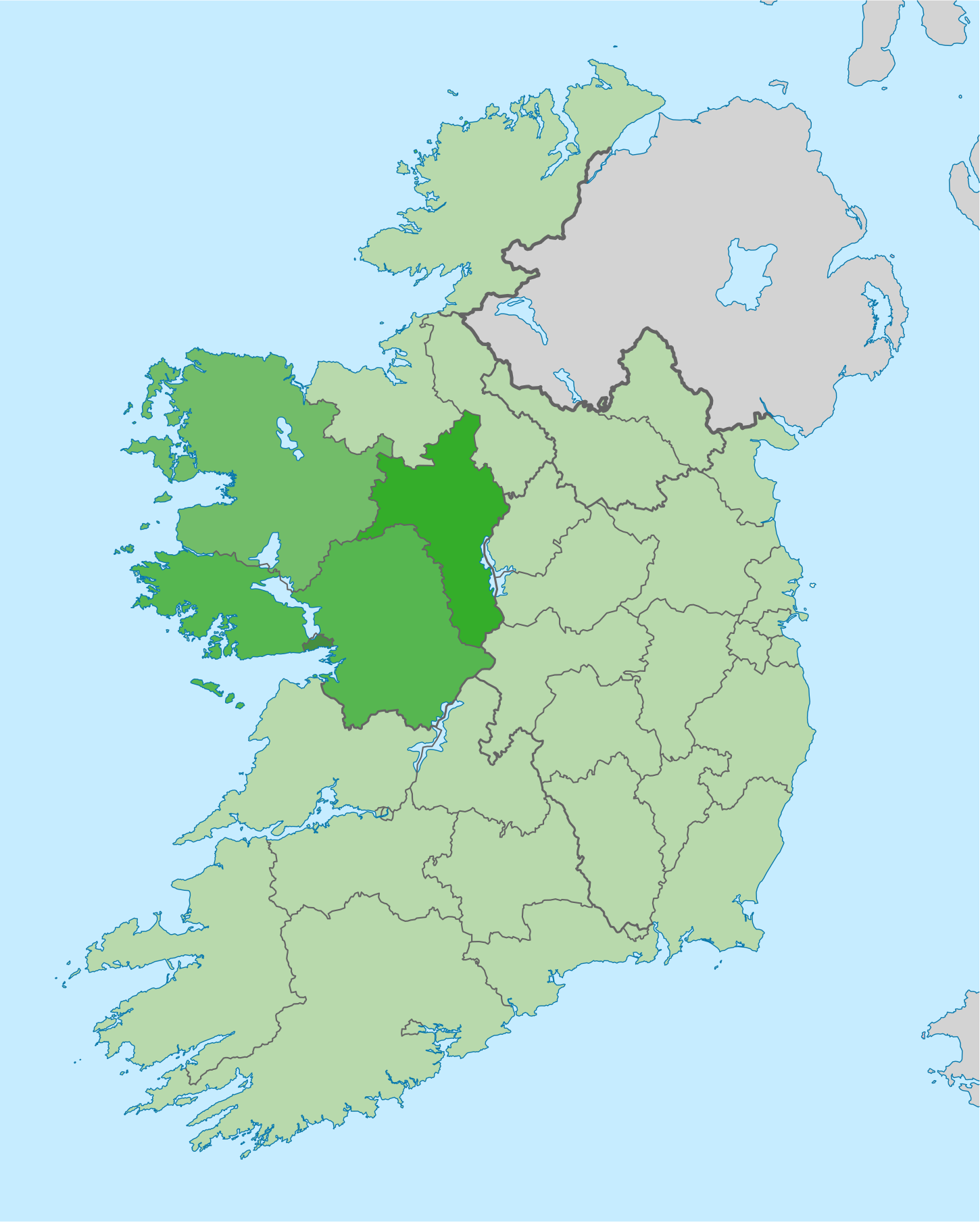
133:Ireland location map West region.svg
680:
300:
295:
243:
241:
13:
512:
506:
423:
286:
282:
149:
137:
125:
75:
814:
511:
441:licensed with Cc-by-sa-3.0, GFDL
497:
380:
379:
336:Under the following conditions:
307:This file is licensed under the
299:
294:
288:
260:
252:Highlighted West Region counties
230:
92:
31:
21:
494:
150:
768:
684:
493:
410:GNU Free Documentation License
399:GNU Free Documentation License
389:GNU Free Documentation License
138:
26:
1:
439:File:Ireland_location_map.svg
748:
519:Items portrayed in this file
7:
797:Usage on zh.wikivoyage.org
787:Usage on ru.wikivoyage.org
777:Usage on nl.wikivoyage.org
10:
819:
350:same or compatible license
127:
681:
457:1450x1807 (613082 Bytes)
448:1450x1807 (612809 Bytes)
16:
717:10:58, 16 September 2010
496:
394:Free Software Foundation
316:
266:. Modifications made by
257:Ireland location map.svg
196:Ireland_location_map.svg
182:Ireland_location_map.svg
169:16 September 2010, 10:56
99:This is a file from the
36:
738:
476:483x602 (567716 Bytes)
467:483x602 (594450 Bytes)
167:
103:. Information from its
106:description page there
472:2008-07-01T14:13:34Z
463:2008-07-19T18:13:09Z
453:2008-08-25T19:08:46Z
444:2009-09-01T18:04:48Z
758:West Region, Ireland
69:1,450 × 1,807 pixels
65:1,643 × 2,048 pixels
430:Original upload log
331:– to adapt the work
143:Positionskarte von
47:Other resolutions:
61:822 × 1,024 pixels
791:Западная Ирландия
769:Global file usage
746:
669:16 September 2010
597:copyright license
579:copyright license
505:
421:
420:
279:
278:
244:retouched picture
220:
219:
204:derivative work:
121:
120:
101:Wikimedia Commons
32:Global file usage
810:
729:
691:
549:copyright status
535:copyright status
503:
417:
414:
411:
408:
405:
383:
382:
376:
372:
369:
366:
363:
360:
352:as the original.
309:Creative Commons
303:
302:
298:
297:
292:
291:
274:
264:
247:
245:
234:
226:
212:
170:
155:Location map of
154:
142:
134:
128:
117:
96:
95:
89:
83:
72:
57:616 × 768 pixels
53:385 × 480 pixels
49:192 × 240 pixels
43:481 × 599 pixels
818:
817:
813:
812:
811:
809:
808:
807:
767:
747:
735:
727:
683:
682:
679:
678:
677:
676:
675:
674:
673:
672:
670:
660:
659:
658:
656:
641:
640:
639:
638:
637:
636:
635:
634:
632:
621:
620:
619:
618:
617:
615:
603:
602:
601:
599:
576:
575:
574:
573:
572:
571:
570:
569:
567:
555:
554:
553:
551:
532:
531:
530:
529:
528:
526:
510:
509:
508:
459:size correction
432:
427:
426:
425:
415:
412:
409:
406:
403:
374:
373:
370:
367:
364:
361:
358:
357:
315:
304:
285:
284:
235:
221:
210:
159:
147:
132:
123:
122:
111:
110:
109:is shown below.
85:
81:
74:
73:
46:
12:
11:
5:
816:
806:
805:
804:
803:
795:
794:
793:
785:
784:
783:
770:
766:
765:
760:
750:
745:
744:
737:
733:
730:
726:1,450 × 1,807
724:
719:
714:
710:
709:
706:
703:
700:
697:
694:
686:
671:
668:
666:
665:
664:
662:
661:
657:
652:
650:
649:
648:
647:
645:
633:
628:
626:
625:
624:
622:
616:
611:
609:
608:
607:
605:
604:
600:
595:
593:
592:
591:
590:
588:
584:
580:
568:
563:
561:
560:
559:
557:
556:
552:
547:
545:
544:
543:
542:
540:
536:
527:
522:
520:
517:
516:
515:
514:
502:
501:
498:
495:
486:Uploaded with
483:
482:
481:
480:
470:
461:
451:
431:
428:
422:
419:
418:
384:
356:
355:
354:
353:
343:
334:
333:
332:
326:
319:You are free:
306:
305:
287:
281:
280:
277:
276:
236:
229:
218:
217:
216:
215:
202:
191:
187:
186:
185:
184:
177:
173:
172:
166:
162:
161:
135:
126:
119:
118:
97:
87:
86:
40:
35:
34:
29:
24:
19:
9:
6:
4:
3:
2:
815:
802:
799:
798:
796:
792:
789:
788:
786:
782:
779:
778:
776:
775:
774:
764:
761:
759:
756:
755:
754:
742:
736:
731:
725:
723:
720:
718:
715:
712:
711:
707:
704:
701:
698:
695:
693:
692:
690:
667:
655:
651:
631:
627:
614:
610:
598:
594:
566:
562:
550:
546:
525:
521:
518:
499:
492:
491:
490:
489:
479:
475:
471:
469:
466:
462:
460:
456:
452:
450:
447:
443:
442:
440:
437:
436:
435:
401:
400:
395:
391:
390:
385:
378:
377:
362:CC BY-SA 3.0
351:
347:
344:
341:
338:
337:
335:
330:
327:
324:
321:
320:
318:
317:
313:
310:
293:
275:
269:
265:
263:
258:
253:
249:
248:
246:
237:
233:
228:
227:
224:
223:
213:
207:
203:
201:
197:
194:
193:
192:
188:
183:
180:
179:
178:
174:
163:
158:
153:
146:
141:
136:
129:
115:
108:
107:
102:
98:
91:
90:
84:
79:
78:Original file
70:
66:
62:
58:
54:
50:
44:
39:
33:
30:
28:
25:
23:
20:
18:
15:
781:West-Ierland
772:
752:
688:
685:File history
488:derivativeFX
485:
484:
477:
474:NordNordWest
468:
465:NordNordWest
458:
455:NordNordWest
449:
446:NordNordWest
433:
397:
387:
345:
339:
328:
322:
271:
255:
251:
240:
239:
222:
200:NordNordWest
151:
139:
114:You can help
104:
76:
22:File history
565:copyrighted
539:copyrighted
346:share alike
340:attribution
238:This is a
131:Description
749:File usage
702:Dimensions
27:File usage
728:(1.09 MB)
699:Thumbnail
696:Date/Time
654:inception
644:inception
152:English:
140:Deutsch:
500:Captions
329:to remix
323:to share
314:license.
734:Mabuska
713:current
708:Comment
524:depicts
504:English
268:Mabuska
259::
206:Mabuska
157:Ireland
80:
741:Irland
273:
190:Author
176:Source
145:Irland
171:(UTC)
801:西爱尔兰
705:User
416:true
413:true
407:GFDL
371:true
368:true
211:talk
165:Date
17:File
270:.
198::
67:|
63:|
59:|
55:|
51:|
45:.
402:.
214:)
208:(
116:.
71:.
Text is available under the Creative Commons Attribution-ShareAlike License. Additional terms may apply.
