874:"}},"text\/plain":{"en":{"":"inception"}}},"{\"value\":{\"time\":\"+2008-08-13T00:00:00Z\",\"timezone\":0,\"before\":0,\"after\":0,\"precision\":11,\"calendarmodel\":\"http:\\\/\\\/www.wikidata.org\\\/entity\\\/Q1985727\"},\"type\":\"time\"}":{"text\/html":{"en":{"P571":"13 August 2008"}},"text\/plain":{"en":{"P571":"13 August 2008"}}}}": -->
38:
246:
629:
584:
635:
312:
640:
290:
94:
813:"}},"text\/plain":{"en":{"P275":"Creative Commons Attribution-ShareAlike 3.0 Unported"}}},"{\"value\":{\"entity-type\":\"item\",\"numeric-id\":50829104,\"id\":\"Q50829104\"},\"type\":\"wikibase-entityid\"}":{"text\/html":{"en":{"P275":"
269:
1722:
809:"}},"text\/plain":{"en":{"":"copyright license"}}},"{\"value\":{\"entity-type\":\"item\",\"numeric-id\":14946043,\"id\":\"Q14946043\"},\"type\":\"wikibase-entityid\"}":{"text\/html":{"en":{"P275":"
765:"}},"text\/plain":{"en":{"":"copyright status"}}},"{\"value\":{\"entity-type\":\"item\",\"numeric-id\":50423863,\"id\":\"Q50423863\"},\"type\":\"wikibase-entityid\"}":{"text\/html":{"en":{"P6216":"
761:
1687:
950:
1717:
1757:
1682:
1832:
1647:
1557:
1702:
1677:
681:– You must give appropriate credit, provide a link to the license, and indicate if changes were made. You may do so in any reasonable manner, but not in any way that suggests the licensor endorses you or your use.
280:
1762:
814:
810:
766:
1524:
1015:
762:
871:
806:
1657:
1272:
1207:
1876:
601:
1004:}} Quadratische Plattkarte, N-S-Streckung 130 %. Geographische Begrenzung der Karte: * N: 39.9° N * S: 36.7° N * W: 31.6° W * O: 24.7° W {{en|Location
68:
64:
60:
56:
52:
48:
42:
1752:
1197:
817:"}},"text\/plain":{"en":{"P275":"GNU Free Documentation License, version 1.2 or later"}}}}": -->
105:
326:
77:
599:; with no Invariant Sections, no Front-Cover Texts, and no Back-Cover Texts. A copy of the license is included in the section entitled
1667:
857:
840:
792:
1387:
1297:
978:
973:
688:
1477:
1352:
1487:
1457:
776:
1497:
1482:
1452:
1162:
591:
1697:
1672:
1402:
881:
824:
751:
1392:
1362:
1427:
245:
1082:
1512:
1432:
1777:
1462:
1322:
1077:
1437:
1127:
650:
551:
1067:
1032:
1767:
1442:
1407:
1232:
1202:
1014:
More than 100 pages use this file. The following list shows the first 100 pages that use this file only. A
596:
319:
1447:
1502:
1367:
1252:
1492:
1277:
1182:
687:– If you remix, transform, or build upon the material, you must distribute your contributions under the
1517:
1122:
1022:
1592:
1177:
769:"}},"text\/plain":{"en":{"P6216":"copyrighted"}}}}": -->
1212:
1552:
1472:
1422:
1172:
949:
944:
37:
1617:
1587:
1377:
1247:
113:
1662:
1347:
1612:
1707:
1262:
1237:
589:
Permission is granted to copy, distribute and/or modify this document under the terms of the
1227:
647:
1467:
1287:
8:
1732:
1417:
1357:
311:
1412:
1397:
1042:
231:
158:
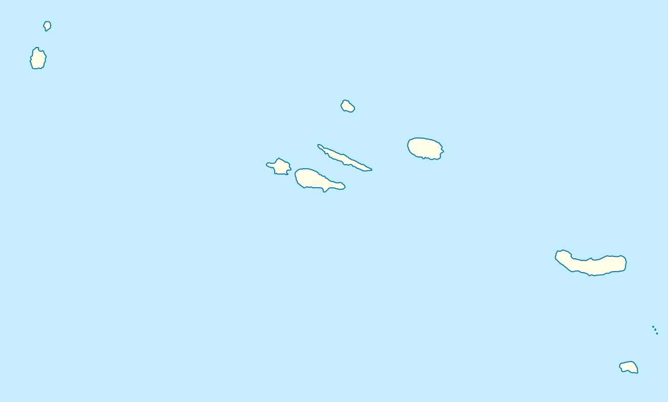
Quadratische
Plattkarte, N-S-Streckung 130 %. Geographische Begrenzung der Karte:
1847:
1137:
989:
960:
575:
I, the copyright holder of this work, hereby publish it under the following licenses:
190:
Equirectangular projection, N/S stretching 130 %. Geographic limits of the map:
100:
1742:
741:
361:
1637:
1217:
1157:
1072:
1572:
1327:
1507:
1342:
1132:
1107:
1337:
1112:
469:
433:
1312:
1302:
1292:
1267:
1222:
1187:
1167:
1097:
1087:
1057:
541:
532:
523:
514:
505:
496:
487:
478:
460:
451:
442:
424:
415:
406:
397:
388:
379:
370:
352:
343:
334:
1627:
1282:
1047:
1117:
1317:
1307:
1192:
1102:
1001:
891:
851:
834:
786:
153:
1542:
1257:
1802:
1142:
1052:
997:
300:
275:
185:
149:
1822:
578:
1857:
1792:
1597:
1147:
1062:
1037:
917:
Click on a date/time to view the file as it appeared at that time.
1862:
1807:
1582:
1332:
1242:
1092:
289:
181:
1372:
1152:
1027:
1607:
1382:
1632:
268:
1787:
1567:
296:
1867:
1842:
1797:
82:(SVG file, nominally 1,304 × 786 pixels, file size: 21 KB)
1817:
213:
88:
735:
Add a one-line explanation of what this file represents
1812:
1208:
List of top-division football clubs in UEFA countries
1012:
318:
This SVG map has been made or improved in the German
1688:Спіс аб’ектаў Сусветнай спадчыны ЮНЕСКА ў Партугаліі
1577:
1533:
996:{{Information |Description= {{de|Positionskarte der
915:
858:
841:
Creative
Commons Attribution-ShareAlike 3.0 Unported
815:
811:
Creative
Commons Attribution-ShareAlike 3.0 Unported
595:, Version 1.2 or any later version published by the
112:
Commons is a freely licensed media file repository.
1758:Кеп:Меттиган карта Португали Азорийн гӀайренаш
1273:Nossa Senhora da Conceição (Angra do Heroísmo)
698:https://creativecommons.org/licenses/by-sa/3.0
93:
1593:Módulu:Mapa de llocalización/datos/Azores/usu
1198:Landscape of the Pico Island Vineyard Culture
704:Creative Commons Attribution-Share Alike 3.0
628:
209:
135:
237:
227:
219:
14:
1683:Шаблон:На карце/Партугалія Азорскія астравы
664:– to copy, distribute and transmit the work
41:Size of this PNG preview of this SVG file:
716:You may select the license of your choice.
1848:Skabelon:Kortpositioner Portugal Azorerne
1833:Шаблон:ПозКартти Португали Азор утравĕсем
1723:টেমপ্লেট:অবস্থান মানচিত্র পর্তুগাল আজোরেস
1588:Módulu:Mapa de llocalización/datos/Azores
1535:The following other wikis use this file:
1648:Ҡалып:ПозКарта Португалия Азор утрауҙары
1733:Šablon:Lokacijska karta Portugal Azores
223:own work, using World Data Base II data
1743:Plantilya:Location map Portugal Azores
1558:قائمة مواقع التراث العالمي في البرتغال
1638:Vorlog:Positionskarte Portugal Azoren
124:
1703:Шаблон:ПК Португалия Азорски острови
1298:Ponta Delgada, Santa Cruz das Flores
651:Attribution-Share Alike 3.0 Unported
607:http://www.gnu.org/copyleft/fdl.html
1778:داڕێژە:Location map Portugal Azores
1353:Ribeira Seca (Vila Franca do Campo)
908:
639:
634:
13:
1163:Guadalupe (Santa Cruz da Graciosa)
740:
734:
715:
625:
574:
317:
294:
273:
174:
142:
125:
75:
1888:
1553:قالب:Location map Portugal Azores
1478:São Miguel (Vila Franca do Campo)
1388:Santa Bárbara (Angra do Heroísmo)
739:
1678:Вінаробны ландшафт вострава Піку
1618:Şablon:Yer xəritəsi Azor adaları
1488:São Pedro (Vila Franca do Campo)
725:
675:Under the following conditions:
646:This file is licensed under the
638:
633:
627:
583:
582:
310:
288:
267:
244:
138:Portugal Azores location map.svg
92:
31:
21:
1718:১৯৮০ এজোরেস দ্বীপপুঞ্জ ভূমিকম্প
1403:Santa Luzia (Angra do Heroísmo)
722:
362:
175:
1530:
1393:Santa Bárbara (Ribeira Grande)
1363:Ribeirinha (Angra do Heroísmo)
1323:Praia (Santa Cruz da Graciosa)
1078:Cedros (Santa Cruz das Flores)
912:
721:
613:GNU Free Documentation License
602:GNU Free Documentation License
592:GNU Free Documentation License
143:
26:
1:
1628:Nutza:Drahdiwaberling/Piedade
1613:Azor adaları zəlzələsi (1980)
1498:São Sebastião (Ponta Delgada)
1483:São Pedro (Angra do Heroísmo)
1453:São Bento (Angra do Heroísmo)
1428:Santo António (Ponta Delgada)
1513:Vila Nova (Praia da Vitória)
1443:Sete Cidades (Ponta Delgada)
1433:Santo António de Nordestinho
1408:Santa Maria Airport (Azores)
1233:Luz (Santa Cruz da Graciosa)
1203:List of airports in Portugal
1009:
747:Items portrayed in this file
568:
7:
1774:Usage on ckb.wikipedia.org
1763:Кальета (Азорийн гӀайренаш)
1739:Usage on ceb.wikipedia.org
1624:Usage on bar.wikipedia.org
1564:Usage on ast.wikipedia.org
1543:Sjabloon:Liggingkaart Asore
1458:São Brás (Praia da Vitória)
1438:Serreta (Angra do Heroísmo)
1368:Ribeirinha (Ribeira Grande)
1253:Mosteiro (Lajes das Flores)
1128:Feteira (Angra do Heroísmo)
10:
1893:
1854:Usage on de.wikipedia.org
1839:Usage on da.wikipedia.org
1829:Usage on cv.wikipedia.org
1784:Usage on cs.wikipedia.org
1749:Usage on ce.wikipedia.org
1729:Usage on bs.wikipedia.org
1714:Usage on bn.wikipedia.org
1694:Usage on bg.wikipedia.org
1654:Usage on be.wikipedia.org
1644:Usage on ba.wikipedia.org
1604:Usage on az.wikipedia.org
1573:Conceição (Ribeira Grande)
1549:Usage on ar.wikipedia.org
1539:Usage on af.wikipedia.org
1123:Fazenda (Lajes das Flores)
1083:Conceição (Ribeira Grande)
1068:Candelária (Ponta Delgada)
1033:Agualva (Praia da Vitória)
1023:ANA Aeroportos de Portugal
689:same or compatible license
306:
132:
127:
1463:São Brás (Ribeira Grande)
1448:São Bartolomeu de Regatos
1178:Lajedo (Lajes das Flores)
909:
470:
434:
16:
1493:São Pedro de Nordestinho
1278:Nossa Senhora do Rosário
1213:Lomba (Lajes das Flores)
1183:Lajes (Praia da Vitória)
724:
655:
597:Free Software Foundation
542:
533:
524:
515:
506:
497:
488:
479:
461:
452:
443:
425:
416:
407:
398:
389:
380:
371:
353:
344:
335:
99:This is a file from the
36:
1658:Орта (Азорскія астравы)
1378:Sabrina Island (Azores)
1248:Matriz (Ribeira Grande)
995:
966:
212:
103:. Information from its
1503:Sé (Angra do Heroísmo)
1348:Ribeira Seca (Calheta)
106:description page there
1863:Santa Cruz das Flores
1808:Santa Barbara (sopka)
1598:Castru de Vila Franca
1518:Vila de São Sebastião
1473:São Mateus da Calheta
1423:Santo Antão (Calheta)
1263:Norte Grande (Azores)
1238:Maia (Ribeira Grande)
1173:João Paulo II Airport
974:18:45, 13 August 2008
945:08:31, 29 August 2008
251:Topographic map (png)
1803:Šablona:LocMap Azory
329:to improve as well.
259:SVG development
180:Location map of the
65:2,560 × 1,543 pixels
1583:Castru de Monchique
1418:Santo Amaro (Velas)
1358:Ribeira das Tainhas
670:– to adapt the work
148:Positionskarte der
47:Other resolutions:
1823:Don João de Castro
1413:Santana (Nordeste)
1398:Santa Cruz (Lagoa)
1228:Lomba de São Pedro
1043:Azores Senior Open
363:Deutsch (Sie-Form)
69:1,304 × 786 pixels
61:1,280 × 772 pixels
57:1,024 × 617 pixels
1877:more global usage
1858:Angra do Heroísmo
1793:Angra do Heroísmo
1753:Азорийн гӀайренаш
1531:Global file usage
1468:São Jorge Airport
1288:Pico da Esperança
1138:Fonte do Bastardo
1007:
825:copyright license
807:copyright license
733:
624:
623:
565:
564:
560:
559:
554:
299:was created with
121:
120:
101:Wikimedia Commons
32:Global file usage
1884:
1668:Ангра-ду-Эраіжму
1218:Lomba da Fazenda
1158:Graciosa Airport
1073:Caveira (parish)
986:
957:
919:
777:copyright status
763:copyright status
731:
711:
708:
705:
702:
699:
691:as the original.
648:Creative Commons
642:
641:
637:
636:
631:
630:
620:
617:
614:
611:
608:
586:
585:
579:
555:
550:
314:
307:
292:
283:
271:
248:
215:
179:
147:
139:
133:
117:
96:
95:
89:
83:
72:
53:640 × 386 pixels
49:320 × 193 pixels
43:800 × 482 pixels
1892:
1891:
1887:
1886:
1885:
1883:
1882:
1881:
1529:
1328:Quatro Ribeiras
1008:
992:
984:
963:
955:
911:
910:
907:
906:
905:
904:
903:
902:
901:
900:
898:
888:
887:
886:
884:
869:
868:
867:
866:
865:
864:
863:
862:
860:
849:
848:
847:
846:
845:
843:
831:
830:
829:
827:
804:
803:
802:
801:
800:
799:
798:
797:
795:
783:
782:
781:
779:
760:
759:
758:
757:
756:
754:
738:
737:
736:
719:
718:
717:
713:
712:
709:
706:
703:
700:
697:
696:
654:
643:
618:
615:
612:
609:
606:
577:
576:
571:
566:
561:
556:
544:
535:
526:
517:
508:
499:
490:
481:
472:
463:
454:
445:
436:
427:
418:
409:
400:
391:
382:
373:
364:
355:
346:
337:
333:
330:
320:Kartenwerkstatt
305:
304:
286:
285:
279:
262:
252:
249:
188:
156:
137:
130:
123:
122:
111:
110:
109:is shown below.
85:
81:
74:
73:
46:
12:
11:
5:
1890:
1879:of this file.
1873:
1872:
1871:
1870:
1865:
1860:
1852:
1851:
1850:
1845:
1837:
1836:
1835:
1827:
1826:
1825:
1820:
1815:
1810:
1805:
1800:
1795:
1790:
1788:Furnas (sopka)
1782:
1781:
1780:
1772:
1771:
1770:
1765:
1760:
1755:
1747:
1746:
1745:
1737:
1736:
1735:
1727:
1726:
1725:
1720:
1712:
1711:
1710:
1705:
1700:
1692:
1691:
1690:
1685:
1680:
1675:
1670:
1665:
1660:
1652:
1651:
1650:
1642:
1641:
1640:
1635:
1633:Topo (Calheta)
1630:
1622:
1621:
1620:
1615:
1610:
1602:
1601:
1600:
1595:
1590:
1585:
1580:
1575:
1570:
1562:
1561:
1560:
1555:
1547:
1546:
1545:
1532:
1527:to this file.
1521:
1520:
1515:
1510:
1508:Topo (Calheta)
1505:
1500:
1495:
1490:
1485:
1480:
1475:
1470:
1465:
1460:
1455:
1450:
1445:
1440:
1435:
1430:
1425:
1420:
1415:
1410:
1405:
1400:
1395:
1390:
1385:
1380:
1375:
1370:
1365:
1360:
1355:
1350:
1345:
1343:Ribeira Quente
1340:
1335:
1330:
1325:
1320:
1315:
1310:
1305:
1300:
1295:
1290:
1285:
1280:
1275:
1270:
1265:
1260:
1255:
1250:
1245:
1240:
1235:
1230:
1225:
1220:
1215:
1210:
1205:
1200:
1195:
1190:
1185:
1180:
1175:
1170:
1165:
1160:
1155:
1150:
1145:
1140:
1135:
1133:Flores Airport
1130:
1125:
1120:
1115:
1110:
1108:Faial da Terra
1105:
1100:
1095:
1090:
1085:
1080:
1075:
1070:
1065:
1060:
1055:
1050:
1045:
1040:
1035:
1030:
1025:
1018:is available.
1011:
1006:
1005:
994:
990:
987:
981:
976:
971:
968:
967:
965:
961:
958:
952:
947:
942:
938:
937:
934:
931:
928:
925:
922:
914:
899:
897:13 August 2008
896:
894:
893:
892:
890:
889:
885:
880:
878:
877:
876:
875:
873:
861:
856:
854:
853:
852:
850:
844:
839:
837:
836:
835:
833:
832:
828:
823:
821:
820:
819:
818:
816:
812:
808:
796:
791:
789:
788:
787:
785:
784:
780:
775:
773:
772:
771:
770:
768:
764:
755:
750:
748:
745:
744:
743:
742:
730:
729:
726:
723:
714:
695:
694:
693:
692:
682:
673:
672:
671:
665:
658:You are free:
645:
644:
626:
622:
621:
587:
573:
572:
570:
567:
563:
562:
558:
557:
332:
315:
287:
266:
265:
263:
260:
256:
255:
254:
253:
250:
243:
239:
238:Other versions
235:
234:
229:
225:
224:
221:
217:
216:
214:13 August 2008
211:
207:
206:
205:
204:
201:
198:
195:
173:
172:
169:
166:
163:
140:
131:
129:
126:
119:
118:
97:
87:
86:
40:
35:
34:
29:
24:
19:
9:
6:
4:
3:
2:
1889:
1880:
1878:
1869:
1868:Ponta Delgada
1866:
1864:
1861:
1859:
1856:
1855:
1853:
1849:
1846:
1844:
1843:Ponta Delgada
1841:
1840:
1838:
1834:
1831:
1830:
1828:
1824:
1821:
1819:
1816:
1814:
1811:
1809:
1806:
1804:
1801:
1799:
1798:Ponta do Pico
1796:
1794:
1791:
1789:
1786:
1785:
1783:
1779:
1776:
1775:
1773:
1769:
1766:
1764:
1761:
1759:
1756:
1754:
1751:
1750:
1748:
1744:
1741:
1740:
1738:
1734:
1731:
1730:
1728:
1724:
1721:
1719:
1716:
1715:
1713:
1709:
1706:
1704:
1701:
1699:
1698:Понта Делгада
1696:
1695:
1693:
1689:
1686:
1684:
1681:
1679:
1676:
1674:
1673:Понта-Дэлгада
1671:
1669:
1666:
1664:
1661:
1659:
1656:
1655:
1653:
1649:
1646:
1645:
1643:
1639:
1636:
1634:
1631:
1629:
1626:
1625:
1623:
1619:
1616:
1614:
1611:
1609:
1606:
1605:
1603:
1599:
1596:
1594:
1591:
1589:
1586:
1584:
1581:
1579:
1576:
1574:
1571:
1569:
1568:Pico da Pedra
1566:
1565:
1563:
1559:
1556:
1554:
1551:
1550:
1548:
1544:
1541:
1540:
1538:
1537:
1536:
1528:
1526:
1519:
1516:
1514:
1511:
1509:
1506:
1504:
1501:
1499:
1496:
1494:
1491:
1489:
1486:
1484:
1481:
1479:
1476:
1474:
1471:
1469:
1466:
1464:
1461:
1459:
1456:
1454:
1451:
1449:
1446:
1444:
1441:
1439:
1436:
1434:
1431:
1429:
1426:
1424:
1421:
1419:
1416:
1414:
1411:
1409:
1406:
1404:
1401:
1399:
1396:
1394:
1391:
1389:
1386:
1384:
1381:
1379:
1376:
1374:
1371:
1369:
1366:
1364:
1361:
1359:
1356:
1354:
1351:
1349:
1346:
1344:
1341:
1339:
1336:
1334:
1331:
1329:
1326:
1324:
1321:
1319:
1316:
1314:
1313:Porto Martins
1311:
1309:
1306:
1304:
1303:Porto Formoso
1301:
1299:
1296:
1294:
1293:Ponta Delgada
1291:
1289:
1286:
1284:
1281:
1279:
1276:
1274:
1271:
1269:
1268:Norte Pequeno
1266:
1264:
1261:
1259:
1256:
1254:
1251:
1249:
1246:
1244:
1241:
1239:
1236:
1234:
1231:
1229:
1226:
1224:
1223:Lomba da Maia
1221:
1219:
1216:
1214:
1211:
1209:
1206:
1204:
1201:
1199:
1196:
1194:
1191:
1189:
1188:Lajes Airport
1186:
1184:
1181:
1179:
1176:
1174:
1171:
1169:
1168:Horta Airport
1166:
1164:
1161:
1159:
1156:
1154:
1151:
1149:
1146:
1144:
1141:
1139:
1136:
1134:
1131:
1129:
1126:
1124:
1121:
1119:
1116:
1114:
1111:
1109:
1106:
1104:
1101:
1099:
1098:Doze Ribeiras
1096:
1094:
1091:
1089:
1088:Corvo Airport
1086:
1084:
1081:
1079:
1076:
1074:
1071:
1069:
1066:
1064:
1061:
1059:
1058:Cabo da Praia
1056:
1054:
1051:
1049:
1046:
1044:
1041:
1039:
1036:
1034:
1031:
1029:
1026:
1024:
1021:
1020:
1019:
1017:
1003:
999:
993:
988:
982:
980:
977:
975:
972:
970:
969:
964:
959:
953:
951:
948:
946:
943:
940:
939:
935:
932:
929:
926:
923:
921:
920:
918:
895:
883:
879:
859:
855:
842:
838:
826:
822:
794:
790:
778:
774:
753:
749:
746:
727:
720:
701:CC BY-SA 3.0
690:
686:
683:
680:
677:
676:
674:
669:
666:
663:
660:
659:
657:
656:
652:
649:
632:
604:
603:
598:
594:
593:
588:
581:
580:
553:
549:
545:
540:
536:
531:
527:
522:
518:
513:
509:
504:
500:
495:
491:
486:
482:
477:
473:
468:
464:
459:
455:
450:
446:
441:
437:
432:
428:
423:
419:
414:
410:
405:
401:
396:
392:
387:
383:
378:
374:
369:
365:
360:
356:
351:
347:
342:
338:
331:
328:
324:
321:
316:
313:
309:
308:
302:
298:
291:
282:
277:
270:
264:
258:
257:
247:
242:
241:
240:
236:
233:
230:
226:
222:
218:
208:
202:
199:
196:
193:
192:
191:
187:
183:
178:
170:
167:
164:
161:
160:
159:
155:
151:
146:
141:
134:
115:
108:
107:
102:
98:
91:
90:
84:
79:
78:Original file
70:
66:
62:
58:
54:
50:
44:
39:
33:
30:
28:
25:
23:
20:
18:
15:
1874:
1818:Sete Cidades
1768:Агуа-де-Алту
1608:Azor adaları
1534:
1522:
1283:Pico Airport
1048:Bay of Angra
1013:
991:NordNordWest
962:NordNordWest
954:1,304 × 786
916:
913:File history
684:
678:
667:
661:
600:
590:
547:
538:
529:
520:
511:
502:
493:
484:
475:
466:
457:
448:
439:
435:Plattdüütsch
430:
421:
412:
403:
394:
385:
376:
367:
358:
349:
340:
336:azərbaycanca
327:propose maps
322:
232:NordNordWest
189:
176:
157:
144:
114:You can help
104:
76:
22:File history
1663:Піку (гара)
1338:Ribeira Chã
1318:Posto Santo
1308:Porto Judeu
1193:Lajes Field
1113:Fajã Grande
1103:Estreitinho
793:copyrighted
767:copyrighted
685:share alike
679:attribution
480:slovenščina
136:Description
1525:more links
1258:Mount Pico
1010:File usage
983:652 × 393
930:Dimensions
498:македонски
426:Nederlands
325:. You can
203:E: 24.7° W
200:W: 31.6° W
197:S: 36.7° N
194:N: 39.9° N
171:O: 24.7° W
168:W: 31.6° W
165:S: 36.7° N
162:N: 39.9° N
27:File usage
1143:Fontinhas
1118:Fajãzinha
1053:Biscoitos
1016:full list
927:Thumbnail
924:Date/Time
882:inception
872:inception
569:Licensing
471:sicilianu
453:português
323:(Map Lab)
261:InfoField
177:English:
145:Deutsch:
1813:Graciosa
1708:Пувуасау
1148:Formigas
1063:Calhetas
1038:Algarvia
1002:Portugal
728:Captions
668:to remix
662:to share
653:license.
408:latviešu
399:italiano
390:français
301:Inkscape
278:code is
186:Portugal
154:Portugal
1333:Raminho
1243:Manadas
1093:Covoada
985:(21 KB)
956:(21 KB)
941:current
936:Comment
752:depicts
732:English
525:հայերեն
516:ქართული
507:русский
381:español
372:English
354:Deutsch
345:čeština
128:Summary
80:
1578:Azores
1373:Rosais
1153:Furnas
1028:Achada
998:Azoren
546:
537:
528:
519:
510:
501:
492:
483:
474:
465:
462:română
456:
447:
444:polski
438:
429:
420:
417:magyar
411:
402:
393:
384:
375:
366:
357:
348:
339:
295:This
293:
272:
228:Author
220:Source
182:Azores
150:Azoren
1875:View
1523:View
1383:Salga
534:বাংলা
489:suomi
281:valid
933:User
710:true
707:true
619:true
616:true
610:GFDL
274:The
210:Date
17:File
552:+/−
543:ไทย
297:map
276:SVG
1000:,
184:,
152:,
67:|
63:|
59:|
55:|
51:|
45:.
605:.
548:∙
539:∙
530:∙
521:∙
512:∙
503:∙
494:∙
485:∙
476:∙
467:∙
458:∙
449:∙
440:∙
431:∙
422:∙
413:∙
404:∙
395:∙
386:∙
377:∙
368:∙
359:∙
350:∙
341:∙
303:.
284:.
116:.
71:.
Text is available under the Creative Commons Attribution-ShareAlike License. Additional terms may apply.


