776:"}},"text\/plain":{"en":{"":"coordinates of the point of view"}}},"{\"value\":{\"latitude\":46.919024,\"longitude\":10.918994,\"altitude\":null,\"precision\":1.0e-6,\"globe\":\"http:\\\/\\\/www.wikidata.org\\\/entity\\\/Q2\"},\"type\":\"globecoordinate\"}":{"text\/html":{"en":{"P1259":"46\u00b055'8.486"N, 10\u00b055'8.378"E"}},"text\/plain":{"en":{"P1259":"46\u00b055'8.486\"N, 10\u00b055'8.378\"E"}}},"{\"value\":{\"entity-type\":\"property\",\"numeric-id\":7787,\"id\":\"P7787\"},\"type\":\"wikibase-entityid\"}":{"text\/html":{"en":{"":"
738:"}},"text\/plain":{"en":{"":"inception"}}},"{\"value\":{\"time\":\"+2007-07-20T00:00:00Z\",\"timezone\":0,\"before\":0,\"after\":0,\"precision\":11,\"calendarmodel\":\"http:\\\/\\\/www.wikidata.org\\\/entity\\\/Q1985727\"},\"type\":\"time\"}":{"text\/html":{"en":{"P571":"20 July 2007"}},"text\/plain":{"en":{"P571":"20 July 2007"}}}}": -->
43:
257:
218:
772:
348:
232:
263:
268:
103:
633:"}},"text\/plain":{"en":{"P275":"Creative Commons Attribution-ShareAlike 3.0 Unported"}}},"{\"value\":{\"entity-type\":\"item\",\"numeric-id\":50829104,\"id\":\"Q50829104\"},\"type\":\"wikibase-entityid\"}":{"text\/html":{"en":{"P275":"
844:"}},"text\/plain":{"en":{"":"media type"}}},"{\"value\":\"image\\\/jpeg\",\"type\":\"string\"}":{"text\/html":{"en":{"P1163":"image\/jpeg"}},"text\/plain":{"en":{"P1163":"image\/jpeg"}}}}": -->
629:"}},"text\/plain":{"en":{"":"copyright license"}}},"{\"value\":{\"entity-type\":\"item\",\"numeric-id\":14946043,\"id\":\"Q14946043\"},\"type\":\"wikibase-entityid\"}":{"text\/html":{"en":{"P275":"
585:"}},"text\/plain":{"en":{"":"copyright status"}}},"{\"value\":{\"entity-type\":\"item\",\"numeric-id\":50423863,\"id\":\"Q50423863\"},\"type\":\"wikibase-entityid\"}":{"text\/html":{"en":{"P6216":"
694:"}},"text\/plain":{"en":{"":"source of file"}}},"{\"value\":{\"entity-type\":\"item\",\"numeric-id\":66458942,\"id\":\"Q66458942\"},\"type\":\"wikibase-entityid\"}":{"text\/html":{"en":{"P7482":"
780:"}},"text\/plain":{"en":{"":"heading"}}},"{\"value\":{\"amount\":\"+225\",\"unit\":\"http:\\\/\\\/www.wikidata.org\\\/entity\\\/Q28390\"},\"type\":\"quantity\"}":{"text\/html":{"en":{"P7787":"225
840:
937:{{Information |Description={{nl|1=De Wildspitze, 3774m is de hoogste berg van Tirol en de op één na hoogste van Oostenrijk.}} |Source=Eigen werk |Author=Pirmin Olde Weghuis |Date=2007-07-20 |Permission= |other_versions= }} <!--{{ImageUpload|full}}--> [
309:– You must give appropriate credit, provide a link to the license, and indicate if changes were made. You may do so in any reasonable manner, but not in any way that suggests the licensor endorses you or your use.
201:
215:
984:
695:
634:
630:
586:
841:
777:
773:
691:
582:
735:
626:
1268:
365:
69:
65:
61:
930:
57:
53:
47:
114:
637:"}},"text\/plain":{"en":{"P275":"GNU Free Documentation License, version 1.2 or later"}}}}": -->
82:
363:; with no Invariant Sections, no Front-Cover Texts, and no Back-Cover Texts. A copy of the license is included in the section entitled
721:
677:
660:
612:
225:
1374:
1279:
This file contains additional information, probably added from the digital camera or scanner used to create or digitize it.
316:
851:
818:
791:
705:
596:
979:
698:"}},"text\/plain":{"en":{"P7482":"original creation by uploader"}}}}": -->
355:
745:
644:
571:
1405:
1059:
278:
1282:
If the file has been modified from its original state, some details may not fully reflect the modified file.
360:
1049:
315:– If you remix, transform, or build upon the material, you must distribute your contributions under the
589:"}},"text\/plain":{"en":{"P6216":"copyrighted"}}}}": -->
784:"}},"text\/plain":{"en":{"P7787":"225 degree"}}}}": -->
994:
919:
914:
73:
42:
1291:
122:
1453:
951:
353:
Permission is granted to copy, distribute and/or modify this document under the terms of the
275:
8:
1489:
956:
157:
De
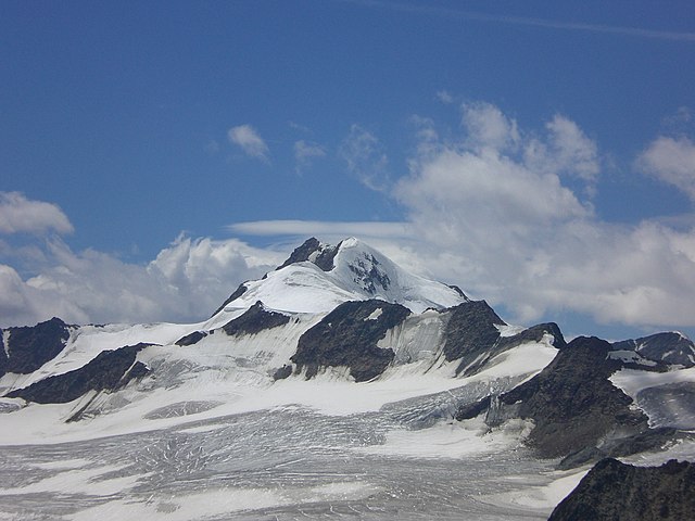
Wildspitze, 3774m is de hoogste berg van Tirol en de op één na hoogste van Oostenrijk.
407:
231:
1575:
1034:
250:
I, the copyright holder of this work, hereby publish it under the following licenses:
109:
561:
1239:
1019:
1039:
1541:
1471:
1308:
1585:
1337:
1149:
1507:
861:
801:
755:
715:
671:
654:
606:
1174:
961:
1109:
1074:
342:
1595:
1318:
1134:
887:
Click on a date/time to view the file as it appeared at that time.
1214:
1089:
1254:
1259:
1249:
1004:
217:
202:
46° 55′ 08.49″ N, 10° 55′ 08.38″ E
1301:
1139:
1099:
1144:
1209:
1189:
1159:
1204:
1194:
1129:
1234:
1164:
1154:
1119:
166:
97:
1224:
1199:
1124:
1104:
1094:
1244:
1229:
1219:
1079:
1069:
1029:
555:
Add a one-line explanation of what this file represents
1169:
1114:
87:(2,816 × 2,112 pixels, file size: 1.79 MB, MIME type:
1184:
1179:
1084:
945:
970:
885:
678:
661:
Creative
Commons Attribution-ShareAlike 3.0 Unported
635:
631:
Creative
Commons Attribution-ShareAlike 3.0 Unported
359:, Version 1.2 or any later version published by the
121:
Commons is a freely licensed media file repository.
531:
506:
481:
456:
431:
1014:
528:
503:
478:
453:
428:
534:
509:
484:
459:
434:
326:https://creativecommons.org/licenses/by-sa/3.0
102:
525:
522:
519:
516:
500:
497:
494:
491:
475:
472:
469:
466:
450:
447:
444:
441:
425:
422:
419:
416:
332:Creative Commons Attribution-Share Alike 3.0
256:
162:
144:
182:
172:
14:
781:
515:
490:
465:
440:
415:
292:– to copy, distribute and transmit the work
391:You may select the license of your choice.
972:The following other wikis use this file:
224:View this and other nearby images on:
947:The following 3 pages use this file:
133:
1040:Liste der Dreitausender in Nordtirol
395:
371:http://www.gnu.org/copyleft/fdl.html
279:Attribution-Share Alike 3.0 Unported
192:
1240:Schweikert (Alpes de l'Ötztal)
1035:Liste der Dreitausender im Weißkamm
878:
267:
262:
13:
1277:
560:
554:
390:
253:
249:
151:
134:
80:
1612:
1284:
559:
147:Wildspitzefromtiefenbachkogel.JPG
1328:Date and time of data generation
792:coordinates of the point of view
774:coordinates of the point of view
545:
347:
346:
303:Under the following conditions:
274:This file is licensed under the
266:
261:
255:
230:
216:
208:
101:
31:
21:
542:
408:View the annotations at Commons
967:
882:
541:
377:GNU Free Documentation License
366:GNU Free Documentation License
356:GNU Free Documentation License
26:
1:
1494:Flash did not fire, auto mode
722:original creation by uploader
696:original creation by uploader
152:
36:
942:
807:46°55'8.486"N, 10°55'8.378"E
567:Items portrayed in this file
243:
207:
7:
1416:Date and time of digitizing
1274:
1001:Usage on ceb.wikipedia.org
985:جبال الالب الرايتيه الشرقيه
976:Usage on arz.wikipedia.org
10:
1617:
1551:Focal length in 35 mm film
1499:Supported Flashpix version
1066:Usage on fr.wikipedia.org
1056:Usage on fa.wikipedia.org
1046:Usage on el.wikipedia.org
1026:Usage on de.wikipedia.org
1011:Usage on cs.wikipedia.org
991:Usage on bg.wikipedia.org
317:same or compatible license
141:
136:
1424:Meaning of each component
1381:File change date and time
879:
405:This image is annotated:
176:
16:
1150:Äussere Schwarze Schneid
544:
361:Free Software Foundation
283:
108:This is a file from the
41:
1525:Custom image processing
1292:CASIO COMPUTER CO.,LTD.
936:
165:
112:. Information from its
1445:Image compression mode
1175:Vordere Ölgrubenspitze
1135:Mittlere Marzellspitze
1075:Alpes de l'Ötztal
1020:Nejvyšší hory Rakouska
236:46.919024; 10.918994
115:description page there
46:Size of this preview:
1463:Maximum land aperture
1355:Horizontal resolution
1215:Hinterer Brunnenkogel
952:Eastern Rhaetian Alps
461:northern peak (3765)
1520:Digital still camera
1255:Hinterer Seelenkogel
1110:Kreuzspitze (Ötztal)
536:Hinterer Brochkogel
74:2,816 × 2,112 pixels
70:2,560 × 1,920 pixels
1419:13:17, 27 July 2007
1389:Y and C positioning
1384:13:17, 27 July 2007
1363:Vertical resolution
1331:13:17, 27 July 2007
1288:Camera manufacturer
1260:Vorderer Brochkogel
1250:Hinterer Brochkogel
957:Western Tauern Alps
915:18:28, 16 June 2009
298:– to adapt the work
186:Pirmin Olde Weghuis
52:Other resolutions:
1559:Scene capture type
1546:Auto white balance
1140:Linker Fernerkogel
1005:Wildspitze (bukid)
436:south peak (3772)
66:1,280 × 960 pixels
62:1,024 × 768 pixels
1604:
1603:
1466:3.3 APEX (f/3.14)
1375:1.00
1313:1/500 sec (0.002)
1269:more global usage
1100:Hochvernagtspitze
968:Global file usage
940:
783:
645:copyright license
627:copyright license
553:
414:
413:
388:
387:
241:
240:
190:
189:
130:
129:
110:Wikimedia Commons
32:Global file usage
1608:
1397:Exposure Program
1285:
1090:Hintere Schwärze
927:
889:
829:
828:
823:
597:copyright status
583:copyright status
551:
486:Ötztaler Urkund
396:
384:
381:
378:
375:
372:
350:
349:
343:
339:
336:
333:
330:
327:
319:as the original.
276:Creative Commons
270:
269:
265:
264:
259:
258:
237:
234:
220:
219:
213:
212:
211:
205:
204:
193:
178:
168:
156:
148:
142:
126:
105:
104:
98:
92:
90:
77:
58:640 × 480 pixels
54:320 × 240 pixels
48:800 × 600 pixels
1616:
1615:
1611:
1610:
1609:
1607:
1606:
1605:
1448:2.7548209366391
1273:
1145:Hochvernaglwand
966:
941:
933:
925:
881:
880:
877:
876:
875:
874:
873:
872:
871:
870:
868:
858:
857:
856:
854:
839:
838:
837:
836:
835:
834:
833:
832:
831:
830:
826:
824:
821:
812:
811:
810:
808:
798:
797:
796:
794:
771:
770:
769:
768:
767:
766:
765:
764:
762:
752:
751:
750:
748:
733:
732:
731:
730:
729:
728:
727:
726:
724:
712:
711:
710:
708:
689:
688:
687:
686:
685:
684:
683:
682:
680:
669:
668:
667:
666:
665:
663:
651:
650:
649:
647:
624:
623:
622:
621:
620:
619:
618:
617:
615:
603:
602:
601:
599:
580:
579:
578:
577:
576:
574:
558:
557:
556:
539:
538:
533:
530:
527:
524:
521:
518:
514:
513:
508:
505:
502:
499:
496:
493:
489:
488:
483:
480:
477:
474:
471:
468:
464:
463:
458:
455:
452:
449:
446:
443:
439:
438:
433:
430:
427:
424:
421:
418:
402:
394:
393:
392:
382:
379:
376:
373:
370:
341:
340:
337:
334:
331:
328:
325:
324:
282:
271:
252:
251:
246:
235:
209:
200:
199:
196:Camera location
191:
158:
146:
139:
132:
131:
120:
119:
118:is shown below.
94:
88:
86:
79:
78:
51:
12:
11:
5:
1614:
1602:
1601:
1598:
1592:
1591:
1588:
1582:
1581:
1578:
1572:
1571:
1568:
1564:
1563:
1560:
1556:
1555:
1552:
1548:
1547:
1544:
1538:
1537:
1534:
1530:
1529:
1528:Normal process
1526:
1522:
1521:
1518:
1514:
1513:
1510:
1504:
1503:
1500:
1496:
1495:
1492:
1486:
1485:
1482:
1478:
1477:
1474:
1468:
1467:
1464:
1460:
1459:
1456:
1450:
1449:
1446:
1442:
1441:
1440:
1439:
1438:does not exist
1436:
1433:
1430:
1425:
1421:
1420:
1417:
1413:
1412:
1409:
1402:
1401:
1400:Normal program
1398:
1394:
1393:
1390:
1386:
1385:
1382:
1378:
1377:
1372:
1368:
1367:
1364:
1360:
1359:
1356:
1352:
1351:
1348:
1344:
1343:
1340:
1333:
1332:
1329:
1325:
1324:
1321:
1315:
1314:
1311:
1305:
1304:
1299:
1295:
1294:
1289:
1276:
1271:of this file.
1265:
1264:
1263:
1262:
1257:
1252:
1247:
1242:
1237:
1232:
1227:
1222:
1217:
1212:
1210:Rifflkarspitze
1207:
1202:
1197:
1192:
1190:Weissseespitze
1187:
1182:
1177:
1172:
1167:
1162:
1160:Im hintern Eis
1157:
1152:
1147:
1142:
1137:
1132:
1127:
1122:
1117:
1112:
1107:
1102:
1097:
1092:
1087:
1082:
1077:
1072:
1064:
1063:
1062:
1054:
1053:
1052:
1044:
1043:
1042:
1037:
1032:
1024:
1023:
1022:
1017:
1009:
1008:
1007:
999:
998:
997:
989:
988:
987:
982:
969:
965:
964:
959:
954:
944:
939:
938:
935:
931:
928:
924:2,816 × 2,112
922:
917:
912:
908:
907:
904:
901:
898:
895:
892:
884:
869:
866:
864:
863:
862:
860:
859:
855:
850:
848:
847:
846:
845:
843:
817:
816:
815:
814:
813:
809:
806:
804:
803:
802:
800:
799:
795:
790:
788:
787:
786:
785:
779:
775:
763:
760:
758:
757:
756:
754:
753:
749:
744:
742:
741:
740:
739:
737:
725:
720:
718:
717:
716:
714:
713:
709:
706:source of file
704:
702:
701:
700:
699:
697:
693:
692:source of file
681:
676:
674:
673:
672:
670:
664:
659:
657:
656:
655:
653:
652:
648:
643:
641:
640:
639:
638:
636:
632:
628:
616:
611:
609:
608:
607:
605:
604:
600:
595:
593:
592:
591:
590:
588:
584:
575:
570:
568:
565:
564:
563:
562:
550:
549:
546:
543:
412:
411:
403:
400:
389:
386:
385:
351:
323:
322:
321:
320:
310:
301:
300:
299:
293:
286:You are free:
273:
272:
254:
248:
247:
245:
242:
239:
238:
228:
222:
197:
188:
187:
184:
180:
179:
174:
170:
169:
164:
160:
159:
149:
140:
138:
135:
128:
127:
106:
96:
95:
45:
40:
39:
34:
29:
24:
19:
9:
6:
4:
3:
2:
1613:
1599:
1597:
1594:
1593:
1589:
1587:
1584:
1583:
1579:
1577:
1574:
1573:
1569:
1567:Scene control
1566:
1565:
1561:
1558:
1557:
1553:
1550:
1549:
1545:
1543:
1542:White balance
1540:
1539:
1536:Auto exposure
1535:
1533:Exposure mode
1532:
1531:
1527:
1524:
1523:
1519:
1516:
1515:
1511:
1509:
1506:
1505:
1501:
1498:
1497:
1493:
1491:
1488:
1487:
1483:
1480:
1479:
1475:
1473:
1472:Metering mode
1470:
1469:
1465:
1462:
1461:
1457:
1455:
1454:Exposure bias
1452:
1451:
1447:
1444:
1443:
1437:
1434:
1431:
1428:
1427:
1426:
1423:
1422:
1418:
1415:
1414:
1410:
1407:
1404:
1403:
1399:
1396:
1395:
1391:
1388:
1387:
1383:
1380:
1379:
1376:
1373:
1371:Software used
1370:
1369:
1365:
1362:
1361:
1357:
1354:
1353:
1349:
1346:
1345:
1341:
1339:
1335:
1334:
1330:
1327:
1326:
1322:
1320:
1317:
1316:
1312:
1310:
1309:Exposure time
1307:
1306:
1303:
1300:
1297:
1296:
1293:
1290:
1287:
1286:
1283:
1280:
1272:
1270:
1261:
1258:
1256:
1253:
1251:
1248:
1246:
1243:
1241:
1238:
1236:
1233:
1231:
1228:
1226:
1223:
1221:
1218:
1216:
1213:
1211:
1208:
1206:
1205:Verpeilspitze
1203:
1201:
1198:
1196:
1195:Wildes Mannle
1193:
1191:
1188:
1186:
1183:
1181:
1178:
1176:
1173:
1171:
1168:
1166:
1163:
1161:
1158:
1156:
1153:
1151:
1148:
1146:
1143:
1141:
1138:
1136:
1133:
1131:
1130:Hundstalkogel
1128:
1126:
1123:
1121:
1118:
1116:
1113:
1111:
1108:
1106:
1103:
1101:
1098:
1096:
1093:
1091:
1088:
1086:
1083:
1081:
1078:
1076:
1073:
1071:
1068:
1067:
1065:
1061:
1058:
1057:
1055:
1051:
1048:
1047:
1045:
1041:
1038:
1036:
1033:
1031:
1028:
1027:
1025:
1021:
1018:
1016:
1013:
1012:
1010:
1006:
1003:
1002:
1000:
996:
993:
992:
990:
986:
983:
981:
980:جبل ويلدسپيتز
978:
977:
975:
974:
973:
963:
960:
958:
955:
953:
950:
949:
948:
934:
929:
923:
921:
918:
916:
913:
910:
909:
905:
902:
899:
896:
893:
891:
890:
888:
865:
853:
849:
820:
805:
793:
789:
759:
747:
743:
723:
719:
707:
703:
679:
675:
662:
658:
646:
642:
614:
610:
598:
594:
573:
569:
566:
547:
540:
537:
512:
511:Schuchtkogel
487:
462:
437:
410:
409:
404:
398:
397:
368:
367:
362:
358:
357:
352:
345:
344:
329:CC BY-SA 3.0
318:
314:
311:
308:
305:
304:
302:
297:
294:
291:
288:
287:
285:
284:
280:
277:
260:
233:
229:
227:
226:OpenStreetMap
223:
221:
203:
198:
195:
194:
185:
181:
175:
171:
161:
155:
150:
143:
124:
117:
116:
111:
107:
100:
99:
93:
84:
83:Original file
75:
71:
67:
63:
59:
55:
49:
44:
38:
35:
33:
30:
28:
25:
23:
20:
18:
15:
1481:Light source
1338:focal length
1298:Camera model
1281:
1278:
1266:
1235:Mutmalspitze
1165:Fineilspitze
1155:Schwabenkopf
1120:Fundusfeiler
971:
946:
886:
883:File history
761:20 July 2007
535:
510:
485:
460:
435:
406:
364:
354:
312:
306:
295:
289:
206:
167:20 July 2007
154:Nederlands:
153:
123:You can help
113:
81:
22:File history
1517:File source
1508:Color space
1347:Orientation
1302:EX-Z60
1225:Luibiskogel
1200:Bliggspitze
1125:Watzespitze
1105:Fluchtkogel
1095:Schalfkogel
1060:ویلداشپیتزه
613:copyrighted
587:copyrighted
399:Annotations
313:share alike
307:attribution
145:Description
1586:Saturation
1245:Rofelewand
1230:Ramolkogel
1220:Hohe Geige
1080:Wildspitze
1070:Weisskugel
1050:Βίλτσπίτσε
1030:Wildspitze
962:Wildspitze
943:File usage
900:Dimensions
867:image/jpeg
852:media type
842:media type
89:image/jpeg
27:File usage
1596:Sharpness
1170:Hochwilde
1115:Glockturm
995:Вилдшпице
926:(1.79 MB)
897:Thumbnail
894:Date/Time
746:inception
736:inception
401:InfoField
244:Licensing
1576:Contrast
1562:Standard
1392:Centered
1319:F-number
1275:Metadata
1185:Mooskopf
1180:Saykogel
1085:Similaun
932:Pirmin90
548:Captions
296:to remix
290:to share
281:license.
177:Own work
37:Metadata
1484:Unknown
1476:Pattern
1408:version
1342:18.9 mm
911:current
906:Comment
819:heading
778:heading
572:depicts
552:English
137:Summary
85:
1600:Normal
1590:Normal
1580:Normal
1554:114 mm
1366:72 dpi
1358:72 dpi
1350:Normal
827:degree
782:degree
214:
183:Author
173:Source
1490:Flash
1336:Lens
1323:f/8.4
1267:View
1570:None
1512:sRGB
1411:2.21
1406:Exif
1015:Alpy
903:User
825:225
532:2112
529:2816
520:1320
517:2651
507:2112
504:2816
495:1362
492:2292
482:2112
479:2816
470:1260
457:2112
454:2816
442:1390
432:2112
429:2816
417:1214
383:true
380:true
374:GFDL
338:true
335:true
163:Date
17:File
526:109
523:144
501:158
498:201
476:113
473:151
467:134
445:936
420:933
1435:Cr
1432:Cb
822::
451:60
448:81
426:77
423:92
72:|
68:|
64:|
60:|
56:|
50:.
1502:1
1458:0
1429:Y
369:.
125:.
91:)
76:.
