1027:"}},"text\/plain":{"en":{"":"checksum"}}},"{\"value\":\"dfc09225d5bac922163c9e2e9695ef6e5e7f2d11\",\"type\":\"string\"}":{"text\/html":{"en":{"P4092":"dfc09225d5bac922163c9e2e9695ef6e5e7f2d11"}},"text\/plain":{"en":{"P4092":"dfc09225d5bac922163c9e2e9695ef6e5e7f2d11"}}},"{\"value\":{\"entity-type\":\"property\",\"numeric-id\":459,\"id\":\"P459\"},\"type\":\"wikibase-entityid\"}":{"text\/html":{"en":{"":"
38:
951:"}},"text\/plain":{"en":{"":"inception"}}},"{\"value\":{\"time\":\"+2009-12-29T00:00:00Z\",\"timezone\":0,\"before\":0,\"after\":0,\"precision\":11,\"calendarmodel\":\"http:\\\/\\\/www.wikidata.org\\\/entity\\\/Q1985727\"},\"type\":\"time\"}":{"text\/html":{"en":{"P571":"29 December 2009"}},"text\/plain":{"en":{"P571":"29 December 2009"}}}}": -->
270:
456:
358:
1023:
364:
561:
543:
445:
467:
369:
94:
989:"}},"text\/plain":{"en":{"":"media type"}}},"{\"value\":\"image\\\/svg+xml\",\"type\":\"string\"}":{"text\/html":{"en":{"P1163":"image\/svg+xml"}},"text\/plain":{"en":{"P1163":"image\/svg+xml"}}}}": -->
1031:"}},"text\/plain":{"en":{"":"determination method"}}},"{\"value\":{\"entity-type\":\"item\",\"numeric-id\":13414952,\"id\":\"Q13414952\"},\"type\":\"wikibase-entityid\"}":{"text\/html":{"en":{"P459":"
907:"}},"text\/plain":{"en":{"":"copyright license"}}},"{\"value\":{\"entity-type\":\"item\",\"numeric-id\":42716613,\"id\":\"Q42716613\"},\"type\":\"wikibase-entityid\"}":{"text\/html":{"en":{"P275":"
863:"}},"text\/plain":{"en":{"":"copyright status"}}},"{\"value\":{\"entity-type\":\"item\",\"numeric-id\":50423863,\"id\":\"Q50423863\"},\"type\":\"wikibase-entityid\"}":{"text\/html":{"en":{"P6216":"
1094:"}},"text\/plain":{"en":{"":"data size"}}},"{\"value\":{\"amount\":\"+375731\",\"unit\":\"http:\\\/\\\/www.wikidata.org\\\/entity\\\/Q8799\"},\"type\":\"quantity\"}":{"text\/html":{"en":{"P3575":"375,731
1327:
1297:
1139:"}},"text\/plain":{"en":{"":"height"}}},"{\"value\":{\"amount\":\"+1783\",\"unit\":\"http:\\\/\\\/www.wikidata.org\\\/entity\\\/Q355198\"},\"type\":\"quantity\"}":{"text\/html":{"en":{"P2048":"1,783
1184:"}},"text\/plain":{"en":{"":"width"}}},"{\"value\":{\"amount\":\"+1535\",\"unit\":\"http:\\\/\\\/www.wikidata.org\\\/entity\\\/Q355198\"},\"type\":\"quantity\"}":{"text\/html":{"en":{"P2049":"1,535
1180:
1975:
1960:
1990:
508:– You must give appropriate credit, provide a link to the license, and indicate if changes were made. You may do so in any reasonable manner, but not in any way that suggests the licensor endorses you or your use.
410:– You must give appropriate credit, provide a link to the license, and indicate if changes were made. You may do so in any reasonable manner, but not in any way that suggests the licensor endorses you or your use.
1945:
1872:
1363:
2184:
1032:
908:
864:
68:
64:
1181:
1136:
1091:
1024:
986:
860:
60:
56:
52:
48:
42:
1028:
948:
904:
1307:
105:
77:
911:"}},"text\/plain":{"en":{"P275":"Creative Commons Attribution-ShareAlike 3.0 Germany"}}}}": -->
575:
257:
1326:
1321:
1296:
1291:
1076:
934:
890:
1445:
1490:
515:
417:
1950:
1195:
1150:
1105:
1042:
996:
874:
1069:
958:
918:
849:
1535:
477:
379:
1935:
1855:
1625:
1565:
300:
A weblink to the original file is provided: //commons.wikimedia.org/File:Australia_South_Australia_location_map.svg
1805:
1720:
1485:
1915:
1930:
1845:
1665:
1570:
1470:
2170:
1352:}} Quadratische Plattkarte, N-S-Streckung 117 %. Geographische Begrenzung der Karte: * N: 25.6° S * S: 38.5° S
1830:
1775:
1705:
1650:
800:
1910:
1266:
1261:
37:
1790:
1725:
1615:
1362:
More than 100 pages use this file. The following list shows the first 100 pages that use this file only. A
568:
1860:
1770:
1670:
235:
Australian
Government, Department of Infrastructure, Transport, Regional Development and Local Government
514:– If you remix, transform, or build upon the material, you must distribute your contributions under the
416:– If you remix, transform, or build upon the material, you must distribute your contributions under the
1820:
1700:
1680:
1540:
1510:
1505:
1440:
1098:"}},"text\/plain":{"en":{"P3575":"375,731 byte"}}}}": -->
1850:
1810:
1780:
1595:
1575:
1555:
1420:
1385:
1188:"}},"text\/plain":{"en":{"P2049":"1,535 pixel"}}}}": -->
1143:"}},"text\/plain":{"en":{"P2048":"1,783 pixel"}}}}": -->
867:"}},"text\/plain":{"en":{"P6216":"copyrighted"}}}}": -->
1840:
1815:
1800:
1795:
1755:
1695:
1635:
1550:
1545:
1480:
1370:
2135:
1645:
1640:
1630:
1580:
1560:
1520:
1495:
1460:
1435:
234:
113:
1835:
1750:
1745:
1600:
1425:
1415:
2000:
1035:"}},"text\/plain":{"en":{"P459":"SHA-1"}}}}": -->
348:
PS: In case of refusal of the above terms the author reserves the right to take legal action.
321:
304:
1785:
1765:
1660:
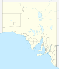
1455:
279:
474:
376:
8:
1735:
1715:
560:
1530:
1410:
1390:
1345:
246:
158:
Quadratische
Plattkarte, N-S-Streckung 117 %. Geographische Begrenzung der Karte:
149:
1890:
1337:
190:
Equirectangular projection, N/S stretching 117 %. Geographic limits of the map:
100:
1965:
839:
610:
181:
1925:
1690:
1585:
1375:
1760:
1675:
1620:
1465:
330:
Please send me a specimen copy or the URL of the website where the file is used.
1525:
1515:
1405:
718:
682:
1655:
1610:
1500:
1380:
1349:
790:
781:
772:
763:
754:
745:
736:
727:
709:
700:
691:
673:
664:
655:
646:
637:
628:
619:
601:
592:
583:
153:
1980:
1730:
1710:
1475:
1895:
1825:
1605:
1450:
1430:
1344:=={{int:filedesc}}== {{Information |Description= {{de|Positionskarte von
1277:
1205:
1160:
1115:
1052:
1006:
968:
928:
884:
185:
2045:
2035:
1740:
1685:
2125:
2075:
1400:
1395:
2150:
2130:
1234:
Click on a date/time to view the file as it appeared at that time.
2155:
2171:
Knowledge:Kartenwerkstatt/Positionskarten/Australien und
Ozeanien
2025:
1865:
1590:
2175:
2115:
2040:
1314:
local government low salience, dont appear on general use maps
82:(SVG file, nominally 1,535 × 1,783 pixels, file size: 367 KB)
2050:
276:
I have published this file as author NordNordWest under the
1936:
Módulu:Mapa de llocalización/datos/Australia
Meridional/usu
1900:
322:
https://creativecommons.org/licenses/by-sa/3.0/de/legalcode
305:
https://creativecommons.org/licenses/by-sa/3.0/de/legalcode
2105:
2085:
2080:
2070:
2100:
2090:
525:
https://creativecommons.org/licenses/by-sa/3.0/de/deed.en
427:
https://creativecommons.org/licenses/by-sa/3.0/de/deed.en
213:
88:
2015:
2165:
2095:
2065:
1931:
Módulu:Mapa de llocalización/datos/Australia
Meridional
2055:
2030:
231:
United States
National Imagery and Mapping Agency data
2160:
2140:
2120:
2010:
1360:
344:
have further questions about the terms of the licence
2110:
2060:
2020:
1881:
1232:
112:
Commons is a freely licensed media file repository.
2145:
935:
Creative
Commons Attribution-ShareAlike 3.0 Germany
909:
Creative
Commons Attribution-ShareAlike 3.0 Germany
567:This map has been made or improved in the German
341:need my postal address for sending a specimen copy
1284:Reverted to version as of 20:05, 29 December 2009
288:is permitted under the following licence terms:
2001:Plantilya:Location map Australia South Australia
2136:Vorlage:Positionskarte Australien Südaustralien
1916:قالب:Location map Australia South Australia/doc
531:Creative Commons Attribution-Share Alike 3.0 de
433:Creative Commons Attribution-Share Alike 3.0 de
320:A copy of or the Uniform Resource Identifier (
303:A copy of or the Uniform Resource Identifier (
93:
1976:Шаблон:На карце/Аўстралія Паўднёвая Аўстралія
1951:شابلون:Location map Australia South Australia
455:
357:
252:
209:
135:
317:The author "NordNordWest/Wikipedia" is named
297:The author "NordNordWest/Wikipedia" is named
242:
219:
14:
1911:قالب:Location map Australia South Australia
1185:
1140:
1095:
491:– to copy, distribute and transmit the work
393:– to copy, distribute and transmit the work
286:free, commercial usage outside of Knowledge
41:Size of this PNG preview of this SVG file:
138:Australia South Australia location map.svg
1961:Ҡалып:ПозКарта Австралия Көньяҡ Австралия
1883:The following other wikis use this file:
1926:Aeropuertu Internacional d'Adelaide
1058:dfc09225d5bac922163c9e2e9695ef6e5e7f2d11
1446:Colonel Light Gardens, South Australia
833:Karte von South Australia, Australien
825:Suburbs of South Australia, Australia
124:
1891:Sjabloon:Liggingkaart Suid-Australië
1491:District Council of Wakefield Plains
1225:
478:Attribution-Share Alike 3.0 Germany
466:
461:
380:Attribution-Share Alike 3.0 Germany
368:
363:
13:
1991:Шаблон:ПК Австралия Южна Австралия
838:
832:
824:
566:
541:
452:
443:
354:
324:) for this licence with every copy
307:) for this licence with every copy
268:
174:
142:
125:
75:
2196:
1536:Flinders Highway, South Australia
837:
1856:Waterfall Gully, South Australia
1626:Lincoln Highway, South Australia
1566:Granite Island (South Australia)
815:
559:
502:Under the following conditions:
473:This file is licensed under the
465:
460:
454:
404:Under the following conditions:
375:This file is licensed under the
367:
362:
356:
92:
31:
21:
1806:Tea Tree Gully, South Australia
1721:Port Broughton, South Australia
1486:District Council of Alexandrina
812:
611:
175:
1878:
1846:Victor Harbor, South Australia
1666:Murray Bridge, South Australia
1571:Hacks Lagoon Conservation Park
1471:Crystal Brook, South Australia
1229:
811:
284:in Knowledge. This means that
143:
26:
1:
1831:Torrens Park, South Australia
1776:Sheidow Park, South Australia
1706:Peterborough, South Australia
1651:Mount Barker, South Australia
1946:مونت قامبیر، گونئی اوسترالیا
1896:Anna Creek Station-voerkraal
1791:Tailem Bend, South Australia
1726:Port Elliot, South Australia
1616:Leigh Creek, South Australia
1357:
845:Items portrayed in this file
7:
1997:Usage on ceb.wikipedia.org
1942:Usage on azb.wikipedia.org
1922:Usage on ast.wikipedia.org
1861:Wellington, South Australia
1771:Roseworthy, South Australia
1671:Naracoorte, South Australia
10:
2201:
2046:Hahndorf (South Australia)
2036:Goodwood (South Australia)
2007:Usage on de.wikipedia.org
1987:Usage on bg.wikipedia.org
1972:Usage on be.wikipedia.org
1957:Usage on ba.wikipedia.org
1907:Usage on ar.wikipedia.org
1887:Usage on af.wikipedia.org
1821:Thevenard, South Australia
1701:Padthaway, South Australia
1681:Nuriootpa, South Australia
1541:Gladstone, South Australia
1511:Emu Field, South Australia
1506:Elizabeth, South Australia
1441:Chadinga Conservation Park
555:
516:same or compatible license
418:same or compatible license
132:
127:
2126:Melrose (South Australia)
2076:Aldgate (South Australia)
1851:Wallaroo, South Australia
1811:Teringie, South Australia
1781:Snowtown, South Australia
1596:Karoonda, South Australia
1576:Hahndorf, South Australia
1556:Goodwood, South Australia
1421:Birdwood, South Australia
1386:Alberton, South Australia
1226:
719:
683:
333:Please write an email to
224:
16:
1841:Uraidla, South Australia
1816:Terowie, South Australia
1801:Taperoo, South Australia
1796:Tanunda, South Australia
1756:Renmark, South Australia
1696:Osborne, South Australia
1636:Melrose, South Australia
1551:Glossop, South Australia
1546:Glenelg, South Australia
1481:Cummins, South Australia
1371:Acraman impact structure
814:
791:
782:
773:
764:
755:
746:
737:
728:
710:
701:
692:
674:
665:
656:
647:
638:
629:
620:
602:
593:
584:
482:
384:
99:This is a file from the
36:
1646:Morgan, South Australia
1641:Monash, South Australia
1631:Marree, South Australia
1581:Hawker, South Australia
1561:Goolwa, South Australia
1521:Farina, South Australia
1496:Dublin, South Australia
1461:Copley, South Australia
1436:Ceduna, South Australia
1343:
1322:20:05, 29 December 2009
1313:
1283:
212:
103:. Information from its
2151:Flughafen Port Augusta
2131:Cook (South Australia)
1836:Truro, South Australia
1751:Quorn, South Australia
1746:Port Wakefield Highway
1601:Keith, South Australia
1426:Burra, South Australia
1416:Berri, South Australia
546:
448:
273:
106:description page there
2156:Flugplatz Coober Pedy
1786:South Eastern Freeway
1766:Robe, South Australia
1661:Mount Toondina crater
1456:Cook, South Australia
545:
447:
272:
2026:Woomera (Australien)
1070:determination method
1029:determination method
578:to improve as well.
69:1,535 × 1,783 pixels
65:1,763 × 2,048 pixels
1736:Port Lincoln Prison
1716:Port Augusta Prison
1292:21:54, 4 April 2010
1262:22:08, 4 April 2010
497:– to adapt the work
399:– to adapt the work
148:Positionskarte von
47:Other resolutions:
2176:Burra (Australien)
2116:Anna Creek Station
2041:Keith (Australien)
1531:Fleurieu Peninsula
1411:Barossa Valley Way
1391:Anna Creek Station
612:Deutsch (Sie-Form)
547:
449:
274:
61:882 × 1,024 pixels
2185:more global usage
1879:Global file usage
1355:
1187:
1142:
1097:
919:copyright license
905:copyright license
831:
823:
809:
808:
803:
553:
552:
353:
352:
261:
258:Reusing this file
121:
120:
101:Wikimedia Commons
32:Global file usage
2192:
1691:Oodnadatta Track
1586:Hindmarsh Island
1376:Adelaide Airport
1334:
1309:Roke~commonswiki
1304:
1274:
1236:
1214:
1169:
1124:
1079:
1074:
974:29 December 2009
875:copyright status
861:copyright status
829:
821:
804:
799:
563:
556:
544:
538:
535:
532:
529:
526:
518:as the original.
475:Creative Commons
469:
468:
464:
463:
458:
457:
446:
440:
437:
434:
431:
428:
420:as the original.
377:Creative Commons
371:
370:
366:
365:
360:
359:
271:
265:
264:
255:
226:
215:
214:29 December 2009
180:Location map of
179:
147:
139:
133:
117:
96:
95:
89:
83:
72:
57:661 × 768 pixels
53:413 × 480 pixels
49:207 × 240 pixels
43:516 × 599 pixels
2200:
2199:
2195:
2194:
2193:
2191:
2190:
2189:
2051:Waterfall Gully
1877:
1761:Riddoch Highway
1676:Neptune Islands
1621:Limestone Coast
1466:Crawford crater
1356:
1346:South Australia
1340:
1332:
1310:
1302:
1280:
1272:
1228:
1227:
1224:
1223:
1222:
1221:
1220:
1219:
1218:
1217:
1215:
1212:
1202:
1201:
1200:
1198:
1179:
1178:
1177:
1176:
1175:
1174:
1173:
1172:
1170:
1167:
1157:
1156:
1155:
1153:
1134:
1133:
1132:
1131:
1130:
1129:
1128:
1127:
1125:
1122:
1112:
1111:
1110:
1108:
1089:
1088:
1087:
1086:
1085:
1084:
1083:
1082:
1081:
1080:
1075:
1072:
1063:
1062:
1061:
1059:
1049:
1048:
1047:
1045:
1022:
1021:
1020:
1019:
1018:
1017:
1016:
1015:
1013:
1003:
1002:
1001:
999:
984:
983:
982:
981:
980:
979:
978:
977:
975:
965:
964:
963:
961:
946:
945:
944:
943:
942:
941:
940:
939:
937:
925:
924:
923:
921:
902:
901:
900:
899:
898:
897:
896:
895:
893:
881:
880:
879:
877:
858:
857:
856:
855:
854:
852:
836:
835:
834:
827:
826:
805:
793:
784:
775:
766:
757:
748:
739:
730:
721:
712:
703:
694:
685:
676:
667:
658:
649:
640:
631:
622:
613:
604:
595:
586:
582:
579:
569:Kartenwerkstatt
554:
549:
548:
542:
539:
536:
533:
530:
528:CC BY-SA 3.0 de
527:
524:
523:
481:
470:
451:
450:
444:
441:
438:
435:
432:
430:CC BY-SA 3.0 de
429:
426:
425:
383:
372:
280:CC-BY-SA-3.0-DE
269:
188:
182:South Australia
156:
150:South Australia
137:
130:
123:
122:
111:
110:
109:is shown below.
85:
81:
74:
73:
46:
12:
11:
5:
2198:
2187:of this file.
2181:
2180:
2179:
2178:
2173:
2168:
2163:
2158:
2153:
2148:
2143:
2138:
2133:
2128:
2123:
2118:
2113:
2108:
2103:
2098:
2093:
2088:
2083:
2078:
2073:
2068:
2063:
2058:
2053:
2048:
2043:
2038:
2033:
2028:
2023:
2018:
2013:
2005:
2004:
2003:
1995:
1994:
1993:
1985:
1984:
1983:
1978:
1970:
1969:
1968:
1963:
1955:
1954:
1953:
1948:
1940:
1939:
1938:
1933:
1928:
1920:
1919:
1918:
1913:
1905:
1904:
1903:
1901:Acraman-krater
1898:
1893:
1880:
1875:to this file.
1869:
1868:
1863:
1858:
1853:
1848:
1843:
1838:
1833:
1828:
1823:
1818:
1813:
1808:
1803:
1798:
1793:
1788:
1783:
1778:
1773:
1768:
1763:
1758:
1753:
1748:
1743:
1738:
1733:
1728:
1723:
1718:
1713:
1708:
1703:
1698:
1693:
1688:
1683:
1678:
1673:
1668:
1663:
1658:
1653:
1648:
1643:
1638:
1633:
1628:
1623:
1618:
1613:
1608:
1603:
1598:
1593:
1588:
1583:
1578:
1573:
1568:
1563:
1558:
1553:
1548:
1543:
1538:
1533:
1528:
1526:Flaxman crater
1523:
1518:
1516:Eyre Peninsula
1513:
1508:
1503:
1498:
1493:
1488:
1483:
1478:
1473:
1468:
1463:
1458:
1453:
1448:
1443:
1438:
1433:
1428:
1423:
1418:
1413:
1408:
1406:Barossa Valley
1403:
1398:
1393:
1388:
1383:
1378:
1373:
1366:is available.
1359:
1354:
1353:
1342:
1338:
1335:
1331:1,535 × 1,783
1329:
1324:
1319:
1316:
1315:
1312:
1308:
1305:
1301:1,535 × 1,783
1299:
1294:
1289:
1286:
1285:
1282:
1278:
1275:
1271:1,535 × 1,783
1269:
1264:
1259:
1255:
1254:
1251:
1248:
1245:
1242:
1239:
1231:
1216:
1210:
1208:
1207:
1206:
1204:
1203:
1199:
1194:
1192:
1191:
1190:
1189:
1183:
1171:
1165:
1163:
1162:
1161:
1159:
1158:
1154:
1149:
1147:
1146:
1145:
1144:
1138:
1126:
1120:
1118:
1117:
1116:
1114:
1113:
1109:
1104:
1102:
1101:
1100:
1099:
1093:
1068:
1067:
1066:
1065:
1064:
1060:
1057:
1055:
1054:
1053:
1051:
1050:
1046:
1041:
1039:
1038:
1037:
1036:
1034:
1030:
1026:
1014:
1011:
1009:
1008:
1007:
1005:
1004:
1000:
995:
993:
992:
991:
990:
988:
976:
973:
971:
970:
969:
967:
966:
962:
957:
955:
954:
953:
952:
950:
938:
933:
931:
930:
929:
927:
926:
922:
917:
915:
914:
913:
912:
910:
906:
894:
889:
887:
886:
885:
883:
882:
878:
873:
871:
870:
869:
868:
866:
862:
853:
848:
846:
843:
842:
841:
840:
828:
820:
819:
816:
813:
807:
806:
581:
564:
551:
550:
540:
522:
521:
520:
519:
509:
500:
499:
498:
492:
485:You are free:
472:
471:
453:
442:
424:
423:
422:
421:
411:
402:
401:
400:
394:
387:You are free:
374:
373:
355:
351:
350:
346:
345:
342:
328:
327:
326:
325:
318:
310:
309:
308:
301:
298:
262:
250:
249:
244:
240:
239:
238:
237:
232:
221:
217:
216:
211:
207:
206:
205:
204:
201:
198:
195:
173:
172:
169:
166:
163:
140:
131:
129:
126:
119:
118:
97:
87:
86:
40:
35:
34:
29:
24:
19:
9:
6:
4:
3:
2:
2197:
2188:
2186:
2177:
2174:
2172:
2169:
2167:
2164:
2162:
2159:
2157:
2154:
2152:
2149:
2147:
2144:
2142:
2139:
2137:
2134:
2132:
2129:
2127:
2124:
2122:
2119:
2117:
2114:
2112:
2109:
2107:
2106:Victor Harbor
2104:
2102:
2099:
2097:
2094:
2092:
2089:
2087:
2086:Murray Bridge
2084:
2082:
2081:Mount Gambier
2079:
2077:
2074:
2072:
2071:William Creek
2069:
2067:
2064:
2062:
2059:
2057:
2054:
2052:
2049:
2047:
2044:
2042:
2039:
2037:
2034:
2032:
2029:
2027:
2024:
2022:
2019:
2017:
2014:
2012:
2009:
2008:
2006:
2002:
1999:
1998:
1996:
1992:
1989:
1988:
1986:
1982:
1979:
1977:
1974:
1973:
1971:
1967:
1964:
1962:
1959:
1958:
1956:
1952:
1949:
1947:
1944:
1943:
1941:
1937:
1934:
1932:
1929:
1927:
1924:
1923:
1921:
1917:
1914:
1912:
1909:
1908:
1906:
1902:
1899:
1897:
1894:
1892:
1889:
1888:
1886:
1885:
1884:
1876:
1874:
1867:
1864:
1862:
1859:
1857:
1854:
1852:
1849:
1847:
1844:
1842:
1839:
1837:
1834:
1832:
1829:
1827:
1824:
1822:
1819:
1817:
1814:
1812:
1809:
1807:
1804:
1802:
1799:
1797:
1794:
1792:
1789:
1787:
1784:
1782:
1779:
1777:
1774:
1772:
1769:
1767:
1764:
1762:
1759:
1757:
1754:
1752:
1749:
1747:
1744:
1742:
1739:
1737:
1734:
1732:
1729:
1727:
1724:
1722:
1719:
1717:
1714:
1712:
1709:
1707:
1704:
1702:
1699:
1697:
1694:
1692:
1689:
1687:
1684:
1682:
1679:
1677:
1674:
1672:
1669:
1667:
1664:
1662:
1659:
1657:
1656:Mount Gambier
1654:
1652:
1649:
1647:
1644:
1642:
1639:
1637:
1634:
1632:
1629:
1627:
1624:
1622:
1619:
1617:
1614:
1612:
1611:Kuitpo Forest
1609:
1607:
1604:
1602:
1599:
1597:
1594:
1592:
1589:
1587:
1584:
1582:
1579:
1577:
1574:
1572:
1569:
1567:
1564:
1562:
1559:
1557:
1554:
1552:
1549:
1547:
1544:
1542:
1539:
1537:
1534:
1532:
1529:
1527:
1524:
1522:
1519:
1517:
1514:
1512:
1509:
1507:
1504:
1502:
1501:Dukes Highway
1499:
1497:
1494:
1492:
1489:
1487:
1484:
1482:
1479:
1477:
1474:
1472:
1469:
1467:
1464:
1462:
1459:
1457:
1454:
1452:
1449:
1447:
1444:
1442:
1439:
1437:
1434:
1432:
1429:
1427:
1424:
1422:
1419:
1417:
1414:
1412:
1409:
1407:
1404:
1402:
1399:
1397:
1394:
1392:
1389:
1387:
1384:
1382:
1381:Adelaide Gaol
1379:
1377:
1374:
1372:
1369:
1368:
1367:
1365:
1351:
1347:
1341:
1336:
1330:
1328:
1325:
1323:
1320:
1318:
1317:
1311:
1306:
1300:
1298:
1295:
1293:
1290:
1288:
1287:
1281:
1276:
1270:
1268:
1265:
1263:
1260:
1257:
1256:
1252:
1249:
1246:
1243:
1240:
1238:
1237:
1235:
1209:
1197:
1193:
1164:
1152:
1148:
1119:
1107:
1103:
1078:
1071:
1056:
1044:
1040:
1012:image/svg+xml
1010:
998:
994:
972:
960:
956:
936:
932:
920:
916:
892:
888:
876:
872:
851:
847:
844:
817:
810:
802:
798:
794:
789:
785:
780:
776:
771:
767:
762:
758:
753:
749:
744:
740:
735:
731:
726:
722:
717:
713:
708:
704:
699:
695:
690:
686:
681:
677:
672:
668:
663:
659:
654:
650:
645:
641:
636:
632:
627:
623:
618:
614:
609:
605:
600:
596:
591:
587:
580:
577:
573:
570:
565:
562:
558:
557:
517:
513:
510:
507:
504:
503:
501:
496:
493:
490:
487:
486:
484:
483:
479:
476:
459:
419:
415:
412:
409:
406:
405:
403:
398:
395:
392:
389:
388:
386:
385:
381:
378:
361:
349:
343:
340:
339:
338:
336:
331:
323:
319:
316:
315:
314:
311:
306:
302:
299:
296:
295:
294:
293:Online media:
291:
290:
289:
287:
283:
281:
267:
266:
263:
259:
254:
251:
248:
245:
241:
236:
233:
230:
229:
228:
222:
218:
208:
202:
199:
196:
193:
192:
191:
187:
183:
178:
170:
167:
164:
161:
160:
159:
155:
151:
146:
141:
134:
115:
108:
107:
102:
98:
91:
90:
84:
79:
78:Original file
70:
66:
62:
58:
54:
50:
44:
39:
33:
30:
28:
25:
23:
20:
18:
15:
2182:
2101:Port Lincoln
2091:Port Augusta
1882:
1870:
1731:Port Lincoln
1711:Port Augusta
1476:Cudlee Creek
1361:
1339:NordNordWest
1233:
1230:File history
796:
787:
778:
769:
760:
751:
742:
733:
724:
715:
706:
697:
688:
684:Plattdüütsch
679:
670:
661:
652:
643:
634:
625:
616:
607:
598:
589:
585:azərbaycanca
576:propose maps
571:
511:
505:
494:
488:
413:
407:
396:
390:
347:
335:nnwestweb.de
334:
332:
329:
313:Print media:
312:
292:
285:
277:
275:
247:NordNordWest
223:
189:
176:
157:
144:
114:You can help
104:
76:
22:File history
2016:Coober Pedy
1826:Tod Highway
1606:Kingston SE
1451:Coober Pedy
1431:Cape Jervis
891:copyrighted
865:copyrighted
729:slovenščina
512:share alike
506:attribution
414:share alike
408:attribution
203:E: 141.5° E
200:W: 128.5° E
171:O: 141.5° O
168:W: 128.5° O
136:Description
2166:Mungeranie
2096:Port Pirie
2066:Naracoorte
1873:more links
1741:Port Pirie
1686:Oodnadatta
1358:File usage
1350:Australien
1247:Dimensions
997:media type
987:media type
747:македонски
675:Nederlands
574:. You can
253:Permission
197:S: 38.5° S
194:N: 25.6° S
165:S: 38.5° S
162:N: 25.6° S
154:Australien
27:File usage
2056:Maralinga
2031:Riverland
1966:Эйр (күл)
1401:Balhannah
1396:Arkaroola
1364:full list
1244:Thumbnail
1241:Date/Time
1106:data size
1092:data size
959:inception
949:inception
720:sicilianu
702:português
572:(Map Lab)
227:, using
186:Australia
177:English:
145:Deutsch:
2161:Angaston
2141:Lobethal
2121:Tarcoola
2011:Adelaide
1333:(367 KB)
1303:(316 KB)
1273:(367 KB)
1121:375,731
1043:checksum
1025:checksum
818:Captions
657:latviešu
648:italiano
639:français
495:to remix
489:to share
480:license.
397:to remix
391:to share
382:license.
225:Own work
2111:Whyalla
2061:Renmark
2021:Klemzig
1866:Whyalla
1591:Kapunda
1258:current
1253:Comment
850:depicts
822:English
774:հայերեն
765:ქართული
756:русский
630:español
621:English
603:Deutsch
594:čeština
337:if you
128:Summary
80:
2146:Ooldea
1279:Chumwa
1211:1,535
1166:1,783
1151:height
1137:height
830:German
795:
786:
777:
768:
759:
750:
741:
732:
723:
714:
711:română
705:
696:
693:polski
687:
678:
669:
666:magyar
660:
651:
642:
633:
624:
615:
606:
597:
588:
243:Author
220:Source
2183:View
1981:Уаяла
1871:View
1213:pixel
1196:width
1186:pixel
1182:width
1168:pixel
1141:pixel
1077:SHA-1
1033:SHA-1
783:বাংলা
738:suomi
1250:User
1123:byte
1096:byte
537:true
534:true
439:true
436:true
210:Date
17:File
801:+/−
792:ไทย
1348:,
1073::
184:,
152:,
67:|
63:|
59:|
55:|
51:|
45:.
797:∙
788:∙
779:∙
770:∙
761:∙
752:∙
743:∙
734:∙
725:∙
716:∙
707:∙
698:∙
689:∙
680:∙
671:∙
662:∙
653:∙
644:∙
635:∙
626:∙
617:∙
608:∙
599:∙
590:∙
282:"
278:"
260:)
256:(
116:.
71:.
Text is available under the Creative Commons Attribution-ShareAlike License. Additional terms may apply.
